Anosy (Anosy Region)
Due to a strategic sea route running along its coast, Anosy had been an important crossroads for the Malagasy, Muslims, and Europeans. In the mid-1600s, it was the location of the first French colonial settlement in the Indian Ocean. The region was part of the Imerina Kingdom for much of the 1800s and part of the French colony of Madagascar from the late 1800s to 1960.
Its exports have included human slaves (shipped to the Mascarene Islands and the United States in the 1700s), live cattle (exported to Réunion for almost 300 years), sisal, natural rubber, rosy periwinkle, graphite, uranothorianite, lobster, sapphires, and ilmenite. Due to its biodiversity and unique wildlife, efforts commenced in the 1980s to promote environmental conservation and tourism in the region.
The region suffers from poverty; 80% of inhabitants lack access to clean water, 16% suffer from serious respiratory illnesses, and literacy is less than 20%.
Map - Anosy (Anosy Region)
Map
Country - Madagascar
 |
 |
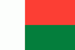
| Flag of Madagascar | |
Madagascar consists of an eponymous main island and numerous smaller peripheral islands. Following the prehistoric breakup of the supercontinent Gondwana, Madagascar split from the Indian subcontinent around 90 million years ago, allowing native plants and animals to evolve in relative isolation; consequently, it is a biodiversity hotspot and one of the world's 17 megadiverse countries, with over 90% of wildlife being endemic. The island has a subtropical to tropical maritime climate.
Currency / Language
| ISO | Currency | Symbol | Significant figures |
|---|---|---|---|
| MGA | Malagasy ariary | Ar | 2 |
| ISO | Language |
|---|---|
| FR | French language |
| MG | Malagasy language |


