Alindao
Alindao is a town and sub-prefecture located in the Central African Republic prefecture of Basse-Kotto. It lies at the junction of the National Route 2 and 22. Alindao had a population of 14,401 as of the 2003 census; and a calculated 2013 population of 15,213. The town is the seat of the Roman Catholic Diocese of Alindao. It has a small airport, Alindao Airport. A Catholic Mission was established at Alindao during French occupation under French Equatorial Africa.
In 1912, the leader of the Banda-Ngbugu people in Alindao, Aju, swore allegiance to the French colonisers. However, he led a local revolt in 1925 and was captured and executed the following year.
In 1927, Norwegian missionary Oscar Cesar Berntz-Lanz established the Elim Mission at Boybinga in the Alindao subprefecture. It was among the first Protestant missions in the colony and included a small dispensary and a school. When World War II broke out in 1939, the family relocated to South Africa.
On 5 January 2013 Séléka rebels took control of Alindao. On 9 May 2017 it was attacked by Anti-balaka which was repelled by Union for Peace in the Central African Republic. On 15 November 2018 at least 112 people were killed and 27 injured in UPC and Anti-balaka attacks on Alindao refugee camp. On 18 March 2021 Alindao was recaptured by government forces supported by Russian paramilitary forces.
Map - Alindao
Map
Country - Central_African_Republic
 |
 |
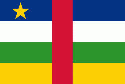
| Flag of the Central African Republic | |
The Central African Republic covers a land area of about 620000 km2. , it had an estimated population of around million. , the Central African Republic is the scene of a civil war, which is ongoing since 2012.
Currency / Language
| ISO | Currency | Symbol | Significant figures |
|---|---|---|---|
| XAF | Central African CFA franc | Fr | 0 |
| ISO | Language |
|---|---|
| FR | French language |
| KG | Kongo language |
| LN | Lingala language |
| SG | Sango language |


