Alibori Department (Alibori)
Alibori is the largest and northernmost department (French: département) of Benin. Externally the department borders the countries of Burkina Faso, Niger, and Nigeria, and internally the departments of Atakora and Borgou. The department of Alibori was created in 1999 when it was split off from Borgou Department and is named after the Alibori River.
, the total population of the department was 867,463, with 431,357 males and 436,106 females. The proportion of women was 50.30%. The total rural population was 75.70%, while the urban population was 24.30%. The total labour force in the department was 201,622, of which 25.40% were women. The proportion of households with no level of education was 83.70%.
Alibori borders Niger to the north, Nigeria to the east, Borgou Department to the south, Atakora Department to the west, and Burkina Faso to the north-west. Alibori is a fertile region consisting of highland and savannah. Cotton, maize and cassava are the major crops grown. The northeast plains slope down to the valley of the Niger River which, along with the Mékrou River, forms the border with Niger. Other major rivers include the Alibori River, Sota River and Pako River. The department contains the bulk of Benin's section of the trans-boundary W National Park.
The climate is mostly humid and tropical. The northern regions of Benin, in general, receives one season of rainfall from May to September, compared to the southern regions which receive two spells from March to July and September to November. Harmattan winds blow from the northeast from December through March. The average temperature from April to June is 40 C in Karimama, while the temperature ranges between 12 and 25 C between November and March. The average elevation of the department is 200 m above the mean sea level.
Map - Alibori Department (Alibori)
Map
Country - Benin
 |
 |
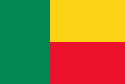
| Flag of Benin | |
From the 17th to the 19th century, political entities in the area included the Kingdom of Dahomey, the city-state of Porto-Novo, and other states to the north. This region was referred to as the Slave Coast from the early 17th century due to the high number of people who were sold and trafficked during the Atlantic slave trade to the New World. France took over the territory in 1894, incorporating it into French West Africa as French Dahomey. In 1960, Dahomey gained full independence from France. As a sovereign state, Benin has had democratic governments, military coups, and military governments. A self-described Marxist–Leninist state called the People's Republic of Benin existed between 1975 and 1990. In 1991, it was replaced by the multi-party Republic of Benin.
Currency / Language
| ISO | Currency | Symbol | Significant figures |
|---|---|---|---|
| XOF | West African CFA franc | Fr | 0 |
| ISO | Language |
|---|---|
| FR | French language |


