Ahal Province (Ahal)
Ahal Region (Ahal welaýaty; from, also Ахалский велаят) is one of five provinces of Turkmenistan. It is in the south-center of the country, bordering Iran and Afghanistan along the Kopet Dag Range. Its area is 97160 km2 and population 939,700 (2005 est.).
In 2000, Ahal Region accounted for 14% of Turkmenistan's population, 11% of the total number of employed, 23% of agricultural production (by value), and 31% of the country's total industrial production.
Ahal's agriculture is irrigated by the Karakum Canal, which stretches all the way across the province from east to west, tracking Turkmenistan's southern border. Another water source is the Tejen River, which flows north from Afghanistan in the southeast corner of the province, passing through two large reservoirs south of the city of Tejen.
Ahal is known for the Battle of Geok Tepe of 1881, today the site of the imposing Saparmurat Hajji Mosque, and for the Bäherden underground warm lake (in the Kov Ata karst cave), both west of Ashgabat.
The capital of Ahal Province is Arkadag, a $1.5 billion mostly greenfield development just west of the city limit of Ashgabat, Turkmenistan's capital city. The city was named in honor of former President Gurbanguly Berdimuhamedov, whose official nickname is Arkadag. The capital until 20 December 2022 was Änew (or Anau), a city on the south-eastern outskirts of Ashgabat. One other notable city is Tejen in the south-east near the border with Mary Province. Turkmenistan's largest city, Ashgabat, is surrounded by Ahal Province, but as the national capital it enjoys status equal to that of a province and is outside Ahal Province's jurisdiction.
Map - Ahal Province (Ahal)
Map


Country - Turkmenistan
 |
 |
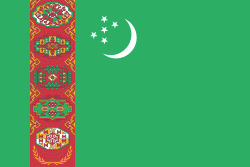
| Flag of Turkmenistan | |
Turkmenistan has long served as a thoroughfare for other nations and cultures. Merv is one of the oldest oasis-cities in Central Asia, and was once the biggest city in the world. It was also one of the great cities of the Islamic world and an important stop on the Silk Road. Annexed by the Russian Empire in 1881, Turkmenistan figured prominently in the anti-Bolshevik movement in Central Asia. In 1925, Turkmenistan became a constituent republic of the Soviet Union, the Turkmen Soviet Socialist Republic (Turkmen SSR); it became independent after the dissolution of the Soviet Union in 1991.
Currency / Language
| ISO | Currency | Symbol | Significant figures |
|---|---|---|---|
| TMT | Turkmenistan manat | m | 2 |
| ISO | Language |
|---|---|
| RU | Russian language |
| TK | Turkmen language |
| UZ | Uzbek language |