Karte (Kartografie) - Cookinseln (Cook Islands)

Cookinseln (Cook Islands)
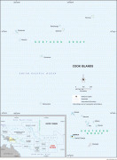
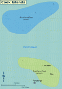
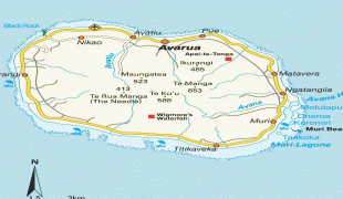
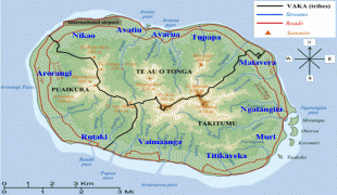
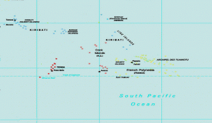
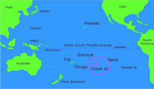
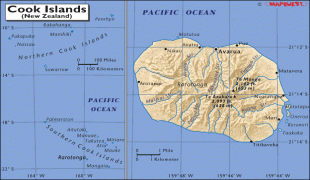
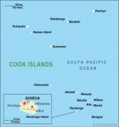
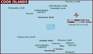
Die Cookinseln (ENS Cook Islands, rarotonganisch Kūki 'Āirani; weitere Bezeichnungen: Cook-Archipel, Mangaia-Archipel, Hervey-Inseln) sind ein unabhängiger Inselstaat in „freier Assoziierung mit Neuseeland“ und eine Inselgruppe im südlichen Pazifik. Ihre Fläche beträgt 236,7 km² und sie haben 14.987 Einwohner (Stand 2021), die zum größten Teil den Cook Islands Māori zuzurechnen sind. Die Hauptstadt ist Avarua auf der Insel Rarotonga. Die Cookinseln sind der erste Staat, in dem Frauen zur Wahl gingen.

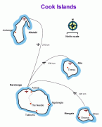
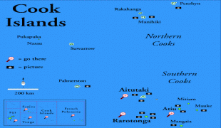
Die Cook-Inseln umfassen 15 Inseln mit einer Landfläche von 236,7 km². Ihre ausschließliche Wirtschaftszone umfasst 1.969.553 km² Meeresfläche.

 
Karte (Kartografie) - Cookinseln (Cook Islands)
Karte (Kartografie)
rakahanga_high_res.j...
3177x3517
simo.ru
cook-islands-map.jpg
2160x2956
www.surftrip.com
cook-islands-map.jpg
2160x2956
surftrip.com
Cook_islands_map.png
1253x1780
upload.wikimedia.org
Cook-Island-map.jpg
1000x1000
3.bp.blogspot.com
Inselplan-Rarotonga-...
1000x1000
www.hot-map.com
cook-LMAP-md.png
965x966
www.operationworld.o...
s13_map.jpg
760x938
www.claycritters.com
COOK+ISLANDS+%25281%...
937x671
4.bp.blogspot.com
map+of+Polynesia.jpg
700x577
1.bp.blogspot.com
map_10___cook_island...
537x667
www.travelswithtwo.c...
map_10___cook_island...
537x667
www.asherworldturns....
aituta1.gif
695x501
www.matrikibeachhuts...
pacific_map_-_01-12-...
650x509
stephenleahy.files.w...
cook-islands.gif
502x502
www.beautifulpacific...
twbmdfsz.gif
500x500
3.bp.blogspot.com
cookis.gif
624x400
go.hrw.com
Cook_Islands_map.jpg
475x507
www.wordtravels.com
Cook_Islands_map.jpg
475x507
www.wordtravels.com
map_of_cook-islands....
466x350
www.lonelyplanet.com
Airport