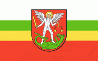
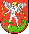
比亞瓦-波德拉斯卡 (Biała Podlaska)
 |
 |
* Biała Podlaska Powiat Website On this page are several maps of the powiat and a link table to take you to individual gmina pages, where you will find information about every city, town, village and hamlet in the powiat.
* Biała Podlaska Gmina Website Maps and further information available
* Photos and History of BP today online (Polish website)
* More Photos of BP today online (Polish website)
* Jewish Gen
* Wiesenthal Centre
* Biała Podlaska - Photo Album - 662 photos and 225 digital paintings discovering the beauty of Biała Podlaska region. (Polish website)
* Holokaust na terenie regionu bialskopodlaskiego w czasie II wojny światowe (Polish website)


