地図 - Tortola West End Sea Plane Base
地図
国
首都
国際空港
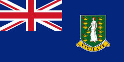
国旗
通貨
言語
ニュース
世界
北アメリカ
イギリス領ヴァージン諸島
Tortola West End Sea Plane Base
Tortola West End Sea Plane Base
地図 - Tortola West End Sea Plane Base
地図
地図 - Tortola West End Sea Plane Base
Google
地図 - Tortola West End Sea Plane Base
Google Earth
地図 - Tortola West End Sea Plane Base
ビング
地図 - Tortola West End Sea Plane Base
ノキア
地図 - Tortola West End Sea Plane Base
オープンストリートマップ
地図 - Tortola West End Sea Plane Base
Esri.WorldImagery
地図 - Tortola West End Sea Plane Base
Esri.WorldStreetMap
地図 - Tortola West End Sea Plane Base
OpenStreetMap.Mapnik
地図 - Tortola West End Sea Plane Base
OpenStreetMap.HOT
地図 - Tortola West End Sea Plane Base
OpenTopoMap
地図 - Tortola West End Sea Plane Base
CartoDB.Positron
地図 - Tortola West End Sea Plane Base
CartoDB.Voyager
地図 - Tortola West End Sea Plane Base
OpenMapSurfer.Roads
地図 - Tortola West End Sea Plane Base
Esri.WorldTopoMap
地図 - Tortola West End Sea Plane Base
Stamen.TonerLite
国 - イギリス領ヴァージン諸島
イギリス領ヴァージン諸島(イギリスりょうヴァージンしょとう)は、カリブ海の西インド諸島にあるイギリスの海外領土(自治領)である. ヴァージン諸島の東側半分. 西側にアメリカ領ヴァージン諸島. 東にイギリス領アンギラがある.
正式名称は British Virgin Islands (英語: ブリティッシュ・ヴァージン・アイランズ). 略号は、BVI.
地図 - イギリス領ヴァージン諸島
通貨 / 言語
ISO
通貨
シンボル
有効数字
USD
アメリカ合衆国ドル
(United States dollar)
$
2
ISO
言語
EN
英語
(English language)
Neighbourhood - 国
言語