地図 - Mamathe
地図
国
首都
国際空港
国旗
通貨
言語
ニュース
世界
アフリカ
レソト
ベレア県
Mamathe
Mamathe
地図 - Mamathe
地図
地図 - Mamathe
Google
地図 - Mamathe
Google Earth
地図 - Mamathe
ビング
地図 - Mamathe
ノキア
地図 - Mamathe
オープンストリートマップ
地図 - Mamathe
Esri.WorldImagery
地図 - Mamathe
Esri.WorldStreetMap
地図 - Mamathe
OpenStreetMap.Mapnik
地図 - Mamathe
OpenStreetMap.HOT
地図 - Mamathe
OpenTopoMap
地図 - Mamathe
CartoDB.Positron
地図 - Mamathe
CartoDB.Voyager
地図 - Mamathe
OpenMapSurfer.Roads
地図 - Mamathe
Esri.WorldTopoMap
地図 - Mamathe
Stamen.TonerLite
国 - レソト
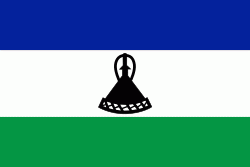
レソトの国旗
レソト王国(レソトおうこく、ソト語: Mmuso wa Lesotho 、Kingdom of Lesotho )、通称レソトは、アフリカ南部に位置する立憲君主制国家. イギリス連邦加盟国のひとつ. 周囲を南アフリカ共和国に囲まれた世界最南の内陸国で、首都はマセルである. 1966年にイギリスから独立した. 非同盟中立を宣言している.
「レソト」とは、「ソト語を話す人々」という意味である. イギリス保護領時代はバストランド保護領と呼ばれていたが、独立と同時にレソトへと改称した.
地図 - レソト
通貨 / 言語
ISO
通貨
シンボル
有効数字
ZAR
ランド
(South African rand)
Rs
2
LSL
ロチ
(Lesotho loti)
L
2
ISO
言語
XH
コサ語
(Xhosa language)
ZU
ズールー語
(Zulu language)
ST
ソト語
(Sotho language)
EN
英語
(English language)
Neighbourhood - 国
南アフリカ共和国
言語