地図 - Long Island
地図
国
首都
国際空港
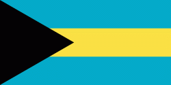
国旗
通貨
言語
ニュース
世界
北アメリカ
バハマ
Long Island
Long Island
地図 - Long Island
地図
地図 - Long Island
Google
地図 - Long Island
Google Earth
地図 - Long Island
ビング
地図 - Long Island
ノキア
地図 - Long Island
オープンストリートマップ
地図 - Long Island
Esri.WorldImagery
地図 - Long Island
Esri.WorldStreetMap
地図 - Long Island
OpenStreetMap.Mapnik
地図 - Long Island
OpenStreetMap.HOT
地図 - Long Island
OpenTopoMap
地図 - Long Island
CartoDB.Positron
地図 - Long Island
CartoDB.Voyager
地図 - Long Island
OpenMapSurfer.Roads
地図 - Long Island
Esri.WorldTopoMap
地図 - Long Island
Stamen.TonerLite
国 - バハマ
、通称バハマは、西インド諸島のバハマ諸島を領有する国家. 英語圏に属し、イギリス連邦の加盟国であると同時に英連邦王国の一国たる立憲君主制国家である. 島国であり、海を隔てて北西にアメリカ合衆国のフロリダ半島が、南西にキューバが、南東にハイチが存在する. 首都はニュー・プロビデンス島のナッソー. バハマ文書が注目を浴びている. 2010年5月3日の人口は35万1461人.
正式名称は Commonwealth of The Bahamas (英語: コムンウェルス・オブ・ザ・バハーマズ)、通称は The Bahamas.
地図 - バハマ
通貨 / 言語
ISO
通貨
シンボル
有効数字
BSD
バハマ・ドル
(Bahamian dollar)
$
2
ISO
言語
EN
英語
(English language)
Neighbourhood - 国
行政区画
都市, 村落,...
Clarence Town
言語
Long Island
(English)
Long Island
(Italiano)
Long Island
(Nederlands)
Long Island
(Français)
Long Island
(Deutsch)
Long Island
(Português)
Лонг-Айленд
(Русский)
Isla Larga
(Español)
Long Island
(Polski)
長島
(中文)
Long Island
(Svenska)
Long Island
(Română)
Лонг Айлънд
(Български)
롱섬
(한국어)
Long Island
(Suomi)
Long Island
(Bahasa Indonesia)
Ilgoji sala
(Lietuvių)
Long Island
(Česky)
Long Island
(Türkçe)
Λονγκ Άιλαντ
(Ελληνικά)