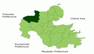
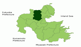
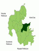
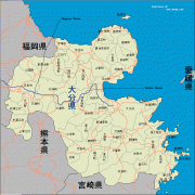
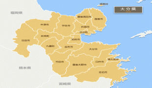
Ōita Prefecture (Oita Prefecture)
 |
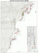
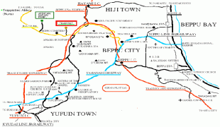
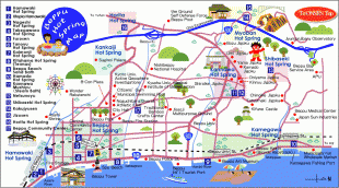
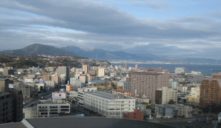
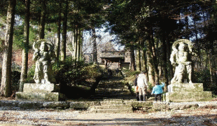
Ōita is the capital and largest city of Ōita Prefecture, with other major cities including Beppu, Nakatsu, and Saiki. Ōita Prefecture is located in the northeast of Kyūshū on the Bungo Channel, connecting the Pacific Ocean and Seto Inland Sea, across from Ehime Prefecture on the island of Shikoku. Ōita Prefecture is famous for its hot springs and is a popular tourist destination in Japan for its onsens and ryokans, particularly in and around the city of Beppu.
Around the 6th century Kyushu consisted of four regions: Tsukushi Province, Hi Province, Kumaso Province and Toyo Province.
Toyo Province was later divided into two regions, upper and lower Toyo Province, called Bungo Province and Buzen Province.
After the Meiji Restoration, districts from Bungo and Buzen provinces were combined to form Ōita Prefecture. These provinces were divided among many local daimyōs and thus a large castle town never formed in Ōita. From this time that whole area became known as "Toyo-no-kuni", which means "Land of Abundance".
The origins of the name Ōita are documented in a report from the early 8th century called the Chronicles of Bungo (豊後国風土記). According to the document, when Emperor Keikō visited the Kyushu region, stopping first in Toyo-no-kuni, he exclaimed that 'This is a vast land, indeed. It shall be known as Okita-Kuni!' Okita-Kuni, meaning "Land of the Great Fields", later came to be written as "Ōita". Present day interpretations based on Ōita's topography state that Oita's name comes from "Okita", meaning "many fields", rather than "vast" or "great" field, because of Ōita's complex terrain.
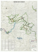
In the Edo period (1603–1867) the town of Hita was the government seat for the entire domain of Kyushu, which was directly controlled by the national government or shōgun at that time. The region became well known for the money-lending industry based out of Hita. Merchants in Hita's Mameda and Kuma districts worked with the national government to create this money-lending industry known as Hita-kin.
Map - Ōita Prefecture (Oita Prefecture)
Map


Country - Japan
 |
 |
| Flag of Japan | |
Japan is the eleventh most populous country in the world, as well as one of the most densely populated and urbanized. About three-fourths of the country's terrain is mountainous, concentrating its population of 124.8 million on narrow coastal plains. Japan is divided into 47 administrative prefectures and eight traditional regions. The Greater Tokyo Area is the most populous metropolitan area in the world, with more than 37.2 million residents.
Currency / Language
| ISO | Currency | Symbol | Significant figures |
|---|---|---|---|
| JPY | Japanese yen | ¥ | 0 |
| ISO | Language |
|---|---|
| JA | Japanese language |

