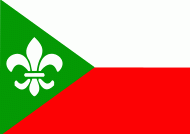
Zundert
 |
 |
Zundert is the birthplace of post-impressionist painter Vincent van Gogh.
The name of Zundert is first mentioned in a certificate dating from 1157, in which the Bishop of Liege confirms a donation from the place "Sunderda". This Sunderda actually relates to the current settlement of Klein-Zundert (Dutch for Small Zundert), one of the first settlements in the area. The local monks, besides their religious labour, were also involved in clearing the land, that was still rough territory, filled with swamps, peats and heath fields. The monks also assisted in improving agricultural methods.
Zundert is still surrounded by a rural environment with nature areas, one of them is the "Buissche Heide", a heath area used for recreation and walking. The Kalmthoutse Heide, across the border with Belgium, is also in the vicinity.
During the Second World War Zundert, Achtmaal, Wernhout and Klein-Zundert were liberated during the allied offensive Operation Pheasant on October 27, Rijsbergen on October 28. Achtmaal was liberated by the 415th Infantry Regiment of the US 104th (Timberwolf) Infantry Division, Zundert and Klein-Zundert by the 413th Infantry Regiment of the 104th (Timberwolf) Infantry Division, and Wernhout and Rijsbergen by the 414th Infantry Regiment of the 104th (Timberwolf) Infantry Division.
At a small distance from the town, an old tavern called "In Den Anker" can be found, which has the oldest license in the Netherlands. It originally dates from 1635, but was rebuilt in 1913.
Map - Zundert
Map
Country - Netherlands
 |
 |
The four largest cities in the Netherlands are Amsterdam, Rotterdam, The Hague and Utrecht. Amsterdam is the country's most populous city and the nominal capital. The Hague holds the seat of the States General, Cabinet and Supreme Court. The Port of Rotterdam is the busiest seaport in Europe. Schiphol is the busiest airport in the Netherlands, and the third busiest in Europe. The Netherlands is a founding member of the European Union, Eurozone, G10, NATO, OECD, and WTO, as well as a part of the Schengen Area and the trilateral Benelux Union. It hosts several intergovernmental organisations and international courts, many of which are centred in The Hague.
Currency / Language
| ISO | Currency | Symbol | Significant figures |
|---|---|---|---|
| EUR | Euro | € | 2 |
| ISO | Language |
|---|---|
| NL | Dutch language |
| FY | West Frisian language |


