Zangilan Rayon (Zangilan Rayon)
Zangilan city is located in the south-western part of Azerbaijan, in the northern part of the Aras River and borders upon Armenia and Iran.
There exists a Mesozoic relief and cretaceous, volcanic and sedimentary rocks are spread in the territory of the district. Remains of the Jurassic and Cretaceous periods spread in mountainous territories are dated back to a period of 150-200 thousand years ago. There are Barbar and Salafir (2270 meters) summits in the territory and this mountain range passes Aras ravine near Aghbend, Vegnali. There is another mountain range in the direction of Sobu-Top-Dallakli villages, beginning from Shukurataz upland and it lowers near to Aras.
The Susan Mountains between the Okhchu and Bargushad Rivers lower in the direction of south-east and make Aghgoyun flat land. This locality consists of sedimentary rocks of the Cretaceous periods. There are Karst caves on both coasts of the Okhchu River. Karabakh mountain ridge is located in the north-eastern part of the district. This ridge creates Goyan valley as it becomes lower.
Forests spread in the mountainous territory of the district. Broad-leaved forests spread at the heights of 1800–2000 meters, gradually become lower and create subalpine and alpine meadows. The territory of the district is rich with healing plants and springs. There are also sources of construction materials, marble, clay, etc. in the district.
Weather conditions of climate and complex relief created the uncommon climate. In a territory along the Aras River with semi-desert and dry steppes winter passes drily, and in higher territories, the climate is mildly warm. The territory is rich of minerals – molybdenum, gold, construction materials, limestone and others. The largest plane forest in Europe is also located in the district.
Map - Zangilan Rayon (Zangilan Rayon)
Map
Country - Azerbaijan
 |
 |
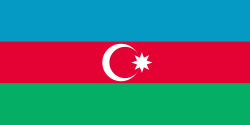
| Flag of Azerbaijan | |
The Azerbaijan Democratic Republic proclaimed its independence from the Transcaucasian Democratic Federative Republic in 1918 and became the first secular democratic Muslim-majority state. In 1920, the country was incorporated into the Soviet Union as the Azerbaijan SSR. The modern Republic of Azerbaijan proclaimed its independence on 30 August 1991, shortly before the dissolution of the Soviet Union in the same year. In September 1991, the ethnic Armenian majority of the Nagorno-Karabakh region formed the self-proclaimed Republic of Artsakh. The region and seven surrounding districts are internationally recognized as part of Azerbaijan pending a solution to the status of the Nagorno-Karabakh through negotiations facilitated by the OSCE, although became de facto independent with the end of the First Nagorno-Karabakh War in 1994. Following the Second Nagorno-Karabakh War in 2020, the seven districts and parts of Nagorno-Karabakh were returned to Azerbaijani control.
Currency / Language
| ISO | Currency | Symbol | Significant figures |
|---|---|---|---|
| AZN | Azerbaijani manat | ₼ | 2 |
| ISO | Language |
|---|---|
| HY | Armenian language |
| AZ | Azerbaijani language |
| RU | Russian language |


