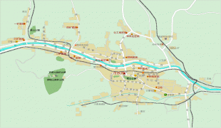
Yangquan
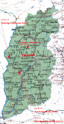
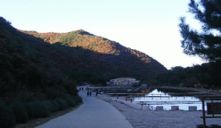
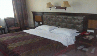
Yangquan is the gateway of the Shanxi province, located in the middle of Taiyuan and Shijiazhuang, 100 kilometers apart. Yangquan is also located in the eastern developed areas and the central and western regions of the combination zone, and also located in the reasonable transport sector through Tianjin, Qingdao, Huanghua. There are the ninth pass and Niangzi pass of the Great Wall, the Cangshan tourist Scenic spot, the Guanshan Academy, the former residence of Shi pingmei, the Liangjiazhai Hot Spring, and the Shinaoshan Forest Park.
In 2017, Yangquan achieved a regional gross domestic product of 67.2 billion yuan, an increase of 6.3 percent at comparable prices. Among them, the added value of the primary industry was 1.04 billion yuan, up 3.0 percent, the added value of the secondary industry was 32.04 billion yuan, an increase of 5.6 percent, and that of the tertiary industry was 34.12 billion yuan, an increase of 7.1 percent. The composition of the three industries was adjusted from 1.7 to 48.0 50.3 in 2016 to 1.5 to 47.7 50.8. The per capita regional GDP was 47790 yuan, or US$7078 at the average exchange rate in 2017.
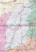
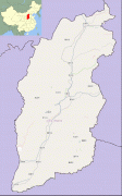
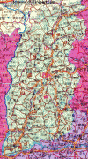
Map - Yangquan
Map


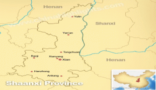


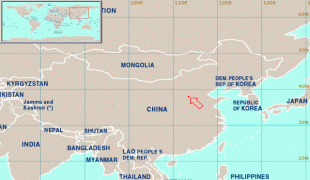


Country - China
 |
 |
| Flag of China | |
Modern Chinese trace their origins to a cradle of civilization in the fertile basin of the Yellow River in the North China Plain. The semi-legendary Xia dynasty in the 21st century BCE and the well-attested Shang and Zhou dynasties developed a bureaucratic political system to serve hereditary monarchies, or dynasties. Chinese writing, Chinese classic literature, and the Hundred Schools of Thought emerged during this period and influenced China and its neighbors for centuries to come. In the third century BCE, Qin's wars of unification created the first Chinese empire, the short-lived Qin dynasty. The Qin was followed by the more stable Han dynasty (206 BCE–220 CE), which established a model for nearly two millennia in which the Chinese empire was one of the world's foremost economic powers. The empire expanded, fractured, and reunified; was conquered and reestablished; absorbed foreign religions and ideas; and made world-leading scientific advances, such as the Four Great Inventions: gunpowder, paper, the compass, and printing. After centuries of disunity following the fall of the Han, the Sui (581–618) and Tang (618–907) dynasties reunified the empire. The multi-ethnic Tang welcomed foreign trade and culture that came over the Silk Road and adapted Buddhism to Chinese needs. The early modern Song dynasty (960–1279) became increasingly urban and commercial. The civilian scholar-officials or literati used the examination system and the doctrines of Neo-Confucianism to replace the military aristocrats of earlier dynasties. The Mongol invasion established the Yuan dynasty in 1279, but the Ming dynasty (1368–1644) re-established Han Chinese control. The Manchu-led Qing dynasty nearly doubled the empire's territory and established a multi-ethnic state that was the basis of the modern Chinese nation, but suffered heavy losses to foreign imperialism in the 19th century.
Currency / Language
| ISO | Currency | Symbol | Significant figures |
|---|---|---|---|
| CNY | Renminbi | ¥ or 元 | 2 |
| ISO | Language |
|---|---|
| ZH | Chinese language |
| UG | Uighur language |
| ZA | Zhuang language |