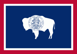
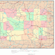
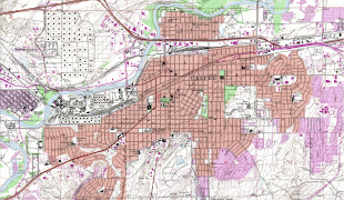
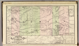
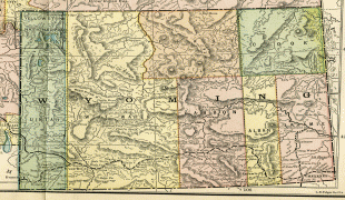
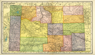
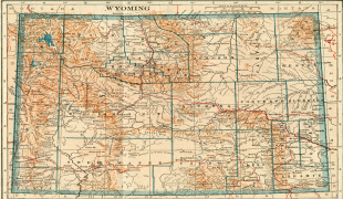
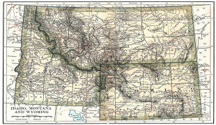
Wyoming
 |
 |
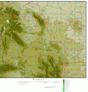
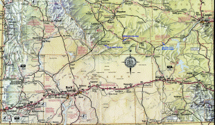
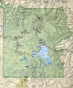
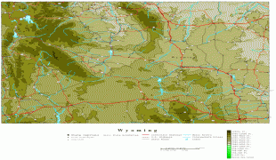
Wyoming's western half is covered mostly by the ranges and rangelands of the Rocky Mountains, while the eastern half of the state is high-elevation prairie called the High Plains. It is drier and windier than the rest of the country, being split between semi-arid and continental climates with greater temperature extremes. Almost half of the land in Wyoming is owned by the federal government, generally protected for public uses. The state ranks 6th by area and fifth by proportion of a state's land owned by the federal government. Federal lands include two national parks (Grand Teton and Yellowstone), two national recreation areas, two national monuments, several national forests, historic sites, fish hatcheries, and wildlife refuges.
Indigenous peoples inhabited the region for thousands of years. Historic and current federally recognized tribes include the Arapaho, Crow, Lakota, and Shoshone. During European exploration, the Spanish Empire was the first to "claim" southern Wyoming. With Mexican independence, it became part of that republic. After defeat in the Mexican–American War, Mexico ceded this territory to the U.S. in 1848.
The region was named "Wyoming" in a bill introduced to Congress in 1865 to provide a temporary government for the territory of Wyoming. It had been used earlier by colonists for the Wyoming Valley in Pennsylvania, and is derived from the Lenape language Munsee word xwé:wamənk, meaning "at the big river flat".
Bills for Wyoming Territory's admission to the union were introduced in both the U.S. Senate and U.S. House of Representatives in December 1889. On March 27, 1890, the House passed the bill and President Benjamin Harrison signed Wyoming's statehood bill; Wyoming became the 44th state in the union.
Historically, European Americans farmed and ranched here, with shepherds and cattle ranchers in conflict over lands. Today Wyoming's economy is largely based on tourism and the extraction of minerals such as coal, natural gas, oil, and trona. Agricultural commodities include barley, hay, livestock, sugar beets, wheat, and wool. It was the first state to allow women the right to vote and the right to assume elected office, as well as the first state to elect a female governor. Due to this part of its history, its main nickname is "The Equality State" and its official state motto is "Equal Rights". It has been a politically conservative state since the 1950s. The Republican presidential nominee has carried the state in every election since 1968.
Several Native American groups originally inhabited the region today known as Wyoming. The Crow, Arapaho, Lakota, and Shoshone were but a few of the original inhabitants European explorers encountered when they first visited the region. What is now southwestern Wyoming was claimed by the Spanish Empire, which extended through the Southwest and Mexico. With Mexican independence in 1821, it was considered part of Alta California. U.S. expansion brought settlers who fought for control. Mexico ceded these territories after its defeat in 1848 in the Mexican–American War.
From the late 18th century, French-Canadian trappers from Québec and Montréal regularly entered the area for trade with the tribes. French toponyms such as Téton and La Ramie are marks of that history.
American John Colter first recorded a description in English of the region in 1807. He was a member of the Lewis and Clark Expedition, which was guided by French Canadian Toussaint Charbonneau and his young Shoshone wife, Sacagawea. At the time, Colter's reports of the Yellowstone area were considered fictional. On a return from Astoria, Robert Stuart and a party of five men discovered South Pass in 1812.
The Oregon Trail later followed that route as emigrants moved to the west coast. In 1850, mountain man Jim Bridger found what is now known as Bridger Pass. Bridger also explored Yellowstone, and filed reports on the region that, like Colter's, were largely regarded at the time as tall tales. The Union Pacific Railroad constructed track through Bridger Pass in 1868. It was used as the route for construction of Interstate 80 through the mountains 90 years later.
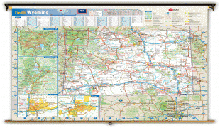
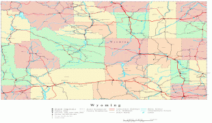
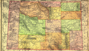
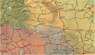
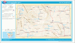
Map - Wyoming
Map


Country - United_States
 |
 |
| Flag of the United States | |
Indigenous peoples have inhabited the Americas for thousands of years. Beginning in 1607, British colonization led to the establishment of the Thirteen Colonies in what is now the Eastern United States. They quarreled with the British Crown over taxation and political representation, leading to the American Revolution and proceeding Revolutionary War. The United States declared independence on July 4, 1776, becoming the first nation-state founded on Enlightenment principles of unalienable natural rights, consent of the governed, and liberal democracy. The country began expanding across North America, spanning the continent by 1848. Sectional division surrounding slavery in the Southern United States led to the secession of the Confederate States of America, which fought the remaining states of the Union during the American Civil War (1861–1865). With the Union's victory and preservation, slavery was abolished nationally by the Thirteenth Amendment.
Currency / Language
| ISO | Currency | Symbol | Significant figures |
|---|---|---|---|
| USD | United States dollar | $ | 2 |
| ISO | Language |
|---|---|
| EN | English language |
| FR | French language |
| ES | Spanish language |