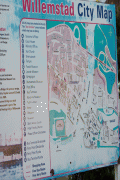
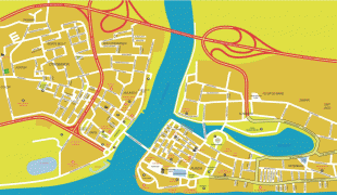
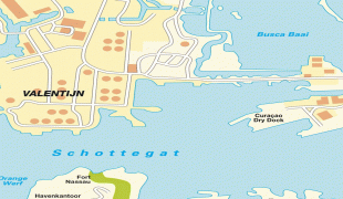
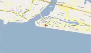
Willemstad
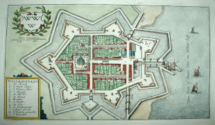
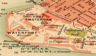
Punda was established in 1634, when the Dutch captured the island from Spain. The original name of Punda was de punt in Dutch. The city was constructed as a walled city. It soon developed into one of the major centres of the Atlantic slave trade which triggered a rapid population growth. In 1674, the Curaçao synagogue was built by Sephardic Portuguese Jews from Amsterdam and Recife, Brazil who had settled in the city as traders. In the late 17th century, there were over 200 houses within the city walls.
In 1675, it was decided to construct the town of Pietermaai outside of the enclosed city. It was to be separated from the city by an area of about 500 metres in which construction was not allowed as not to obstruct the canons in Fort Amsterdam. In 1707, the suburb of Otrobanda was founded. Otrobanda would become the cultural centre of Willemstad. Its name originated from the Papiamentu otro banda, which means "the opposite side". The suburb of Scharloo followed, however Willemstad continued to experience growth. By 1818, the population of Willemstad had grown to 9,536 people. On 13 May 1861, a decision was made to demolish the city walls, and built residential houses in the gap separating Willemstad from Pietermaai.
Around 1925, the booming oil and phosphate industry further stimulated growth, and resulted in the creation of new neighbourhoods. Between 1945 and 1955, Julianadorp and Emmastad were created by Royal Dutch Shell to house the new workers. In 1985, the oil refinery which employed 12,000 people was closed down by Shell. The Government of Curaçao decided to buy the refinery for ƒ 1.00 and take responsibility for all future pollution claims. In 1986, it was leased to the Venezuelan PDVSA, and reopened on a limited scale. In 2017, the PDVSA was hit by punitive sanctions of the United States Government, and attempts have been made to seize the refinery.
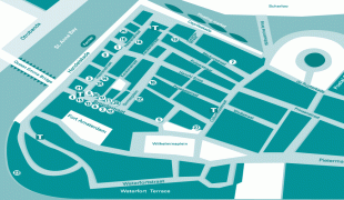
On 30 May 1969, the Curaçao uprising, a strike at a subcontractor of the oil refinery, turned into a riot. The riot resulted in two deaths, 300 arrests and a part of the historic centre burnt down. The Netherlands Marine Corps was sent to Willemstad and the entire city centre was closed down. In 1997, the centre of Willemstad and its former suburbs were designated a UNESCO World Heritage Site. In the 21st century, a large scale program of renovation started.
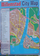
Map - Willemstad
Map


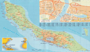

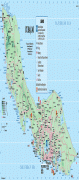

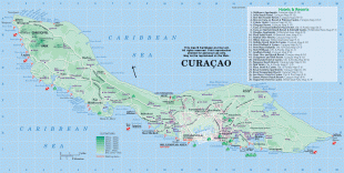


Country - Curaçao
 |
 |
Curaçao was formerly part of the Curaçao and Dependencies colony from 1815 to 1954 and later the Netherlands Antilles from 1954 to 2010, as Island Territory of Curaçao (Eilandgebied Curaçao, Teritorio Insular di Kòrsou), and is now formally called the Country of Curaçao. It includes the main island of Curaçao and the much smaller, uninhabited island of Klein Curaçao ("Little Curaçao"). Curaçao has a population of 158,665 (January 2019 est.), with an area of 444 km2; its capital is Willemstad.
Currency / Language
| ISO | Currency | Symbol | Significant figures |
|---|---|---|---|
| ANG | Netherlands Antillean guilder | Æ’ | 2 |
| ISO | Language |
|---|---|
| NL | Dutch language |