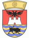
Vlorë County (Qarku i Vlorës)
 |
Vlorë is geographically a very mountainous county. The county stretches along the Adriatic Sea and especially the Ionian Sea, forming the Albanian Riviera. The county has a coastline of 244 km. The coasts on the west can be very steep and rocky with green panoramic vistas and high mountains in the hinterland, including the Ceraunian Mountains. The highest natural point is Maja e Çikës, at 2,044 m. The northwest of the county is mostly located on the peninsula of Karaburun, with a rough relief, steep cliffs, bays and rocky beaches.
With more than 187,000 inhabitants in 2021, the county is the sixth most populous county within Albania, and the third most populous within the Southern Region. Albanians constitute the ethnic majority of the county, including the capital. Greeks, Aromanians, & a few Roma also are present in the ethnic composition of the county.
The port city of Vlorë is the capital of Vlorë County. It is where the Albanian Declaration of Independence was proclaimed on November 28, 1912. Sarandë is one of the most important tourist attractions of the Albanian Riviera, situated on an open sea gulf of the Ionian Sea in the central Mediterranean, about 14 km east of the north end of the Greek island of Corfu. The Butrint National Park, Llogara National Park and Karaburun Sazan National Marine Park are located in Vlorë County. The ancient city of Butrint is an archeological site in Vlorë County, some 14 kilometres south of Sarandë. It is located on a hill overlooking the Vivari Channel and is part of the Butrint National Park.
During antiquity, the city of Vlorë, the homonymous county capital, was known as Aulón (Αυλών, meaning channel or glen, and possibly a translation of another indigenous name). The city was founded as a Greek colony within the territory of Illyria. The Latin name is Aulona, a Latinization of the Ancient Greek name. The medieval and modern Greek name was Αυλώνας /av'lonas/, accusative Αυλώνα /av'lona/, and is the source of the Italian name Valona and of the obsolete English Avlona. During the Ottoman era, the Turkish Avlonya was also common.
The region was also inhabited by the Greek tribe of the Chaonians in classical antiquity. The Ancient Greeks developed the town of Sarandë, which they referred to as Onchesmos (or Anchiasmos). Onchesmos flourished as the port of the Chaonian capital of Phoenice (modern-day Finiq). Another Chaonian settlement was Chimera, identified with Himarë, while the Corinthians founded the colony of Aulon at the bay of Vlorë. Additional ancient settlements in the region included Thronium, Amantia and Oricum. Illyrian tribes were located north of the mouth of Aoos, which is located near the northern limits of the county.
In the Middle Ages, the region was part of the Byzantine Empire, while during the Slavic invasion there is evidence that Byzantine rule was maintained in the area.
In 1204 the region became part of the Despotate of Epirus, but later returned to the Byzantine Empire. In 1335 Albanian tribes descended south and were in possession of the area between Berat and the bay of Vlorë, while in 1345 after the Serbian invasion an independent principality was formed in Vlorë.
In the middle of the 14th century the aristocratic Delvina family ruled Delvinë, and in 1354 Mehmet Ali Pasha Delvina was testified as the owner of the castle and the city.
Map - Vlorë County (Qarku i Vlorës)
Map


Country - Albania
 |
 |
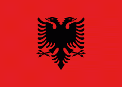
| Flag of Albania | |
Albania has been inhabited by different civilisations over time, such as the Illyrians, Thracians, Ancient Greeks, Romans, Byzantines, Venetians, and Ottomans. The Albanians established the autonomous Principality of Arbër in the 12th century. The Kingdom of Albania and Principality of Albania formed between the 13th and 14th centuries. Prior to the Ottoman conquest of Albania in the 15th century, the Albanian resistance to Ottoman expansion into Europe led by Skanderbeg won them acclaim over most of Europe. Albania remained under Ottoman rule for nearly five centuries, during which many Albanians (known as Arnauts) attained high-ranking offices in the empire, especially in the Southern Balkans and Egypt. Between the 18th and 19th centuries, cultural developments, widely attributed to Albanians having gathered both spiritual and intellectual strength, conclusively led to the Albanian Renaissance. After the defeat of the Ottomans in the Balkan Wars, the modern nation state of Albania declared independence in 1912. In the 20th century, the Kingdom of Albania was invaded by Italy, which formed Greater Albania before becoming a protectorate of Nazi Germany. Enver Hoxha formed the People's Socialist Republic of Albania after World War II, modeled under the terms of Hoxhaism. The Revolutions of 1991 concluded the fall of communism in Albania and eventually the establishment of the current Republic of Albania.
Currency / Language
| ISO | Currency | Symbol | Significant figures |
|---|---|---|---|
| ALL | Albanian lek | L | 2 |
| ISO | Language |
|---|---|
| SQ | Albanian language |
| EL | Greek language |