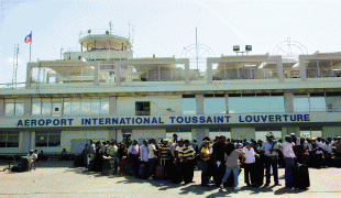
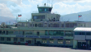
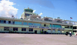
Toussaint Louverture International Airport (Toussaint L'Ouverture International Airport)
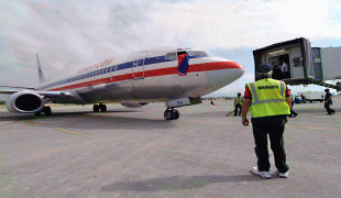
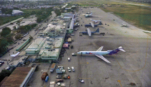
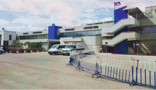
Toussaint Louverture International Airport (Ayewopò Entènasyonal Tousen Louvèti, Aéroport International Toussaint Louverture) is an international airport in Tabarre, a commune of Port-au-Prince in Haiti. The airport is currently the busiest in Haiti and is an operating hub for Sunrise Airways.
It is informally called "the Maïs-Gâté airport", named after the area in the Cul-de-Sac Plain where the airport was built.
During the United States occupation of Haiti the United States Marine Corps stationed Marine Observation units using HS-1 and HS-2 aircraft in what later became Bowen Field (c. 1919).
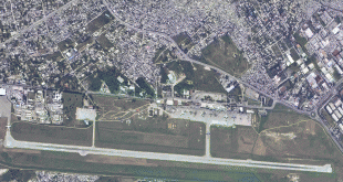
In 1942, the USMC was sent to Haiti to build a facility to service Douglas O-38 aircraft used by Haiti Air Corps to observe Nazi German activity in the region. The USMC built Bowen Field (also known as Chancerelles Airport ), a small civilian and military airport located near Chancerelles area near the Baie de Port-au-Prince. Bowen Field was used by Haiti Air Corps for mail (1943) and passenger (1944) services, then succeeded by the Compagnie haïtienne de transports aériens beginning in 1961. In the 1950s and the 1960s, it served as an airbase for the US military in Haiti. The current airport located further northeast of Bowen Field was developed with grant money from the US government and mostly money collected from Haitian people (taxes, lottery, etc.), opened as François Duvalier International Airport in 1965, after the Haitian president at the time, François "Papa Doc" Duvalier. The old Bowen field was decommissioned after 1994 and is now hosts Internally Displaced Persons Camp and Centre Sportif. The runway is now part of Avenue Haile Selassie.
Duvalier's son and successor, Jean-Claude Duvalier, resigned in 1986. The airport was renamed Port-au-Prince International Airport. Haitian President Jean Bertrand Aristide renamed the airport again as Toussaint Louverture International Airport in 2003 to honor Toussaint Louverture, the leader of the Haitian Revolution.
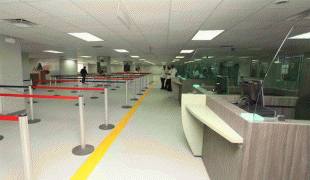
The airport was badly damaged by the 2010 Haiti earthquake. On 25 November 2012, Haitian President Michel Joseph Martelly opened the newly repaired arrivals terminal.
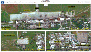
On 7 July 2021, following the assassination of Haitian President Jovenel Moïse, the airport was closed and flights were sent back to their origins.
It is informally called "the Maïs-Gâté airport", named after the area in the Cul-de-Sac Plain where the airport was built.
During the United States occupation of Haiti the United States Marine Corps stationed Marine Observation units using HS-1 and HS-2 aircraft in what later became Bowen Field (c. 1919).
In 1942, the USMC was sent to Haiti to build a facility to service Douglas O-38 aircraft used by Haiti Air Corps to observe Nazi German activity in the region. The USMC built Bowen Field (also known as Chancerelles Airport ), a small civilian and military airport located near Chancerelles area near the Baie de Port-au-Prince. Bowen Field was used by Haiti Air Corps for mail (1943) and passenger (1944) services, then succeeded by the Compagnie haïtienne de transports aériens beginning in 1961. In the 1950s and the 1960s, it served as an airbase for the US military in Haiti. The current airport located further northeast of Bowen Field was developed with grant money from the US government and mostly money collected from Haitian people (taxes, lottery, etc.), opened as François Duvalier International Airport in 1965, after the Haitian president at the time, François "Papa Doc" Duvalier. The old Bowen field was decommissioned after 1994 and is now hosts Internally Displaced Persons Camp and Centre Sportif. The runway is now part of Avenue Haile Selassie.
Duvalier's son and successor, Jean-Claude Duvalier, resigned in 1986. The airport was renamed Port-au-Prince International Airport. Haitian President Jean Bertrand Aristide renamed the airport again as Toussaint Louverture International Airport in 2003 to honor Toussaint Louverture, the leader of the Haitian Revolution.
The airport was badly damaged by the 2010 Haiti earthquake. On 25 November 2012, Haitian President Michel Joseph Martelly opened the newly repaired arrivals terminal.
On 7 July 2021, following the assassination of Haitian President Jovenel Moïse, the airport was closed and flights were sent back to their origins.
| IATA Code | PAP | ICAO Code | MTPP | FAA Code | |
|---|---|---|---|---|---|
| Telephone | Fax | ||||
| Home page |
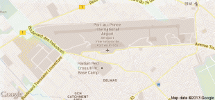
Map - Toussaint Louverture International Airport (Toussaint L'Ouverture International Airport)


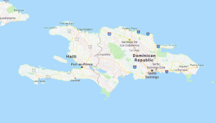
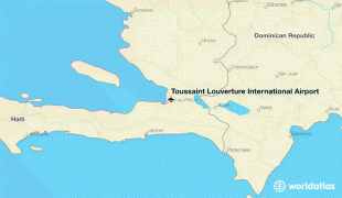
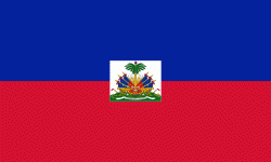
Country - Haiti
 |
 |
| Flag of Haiti | |
The island was originally inhabited by the indigenous Taíno people, who originated in South America. The first Europeans arrived on 5 December 1492 during the first voyage of Christopher Columbus, who initially believed he had found India or China. Columbus subsequently founded the first European settlement in the Americas, La Navidad, on what is now the northeastern coast of Haiti. The island was claimed by Spain and named La Española, forming part of the Spanish Empire until the early 17th century. However, competing claims and settlements by the French led to the western portion of the island being ceded to France in 1697, which was subsequently named Saint-Domingue. French colonists established lucrative sugarcane plantations, worked by vast numbers of slaves brought from Africa, which made the colony one of the richest in the world.
Currency / Language
| ISO | Currency | Symbol | Significant figures |
|---|---|---|---|
| HTG | Haitian gourde | G | 2 |
| USD | United States dollar | $ | 2 |
| ISO | Language |
|---|---|
| FR | French language |
| HT | Haitian Creole language |