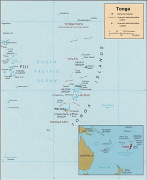
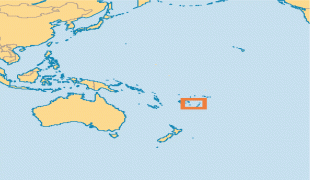
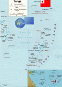
Tonga (Kingdom of Tonga)
 |
 |
| Flag of Tonga | |
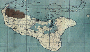
First inhabited roughly 2,500 years ago by the Lapita civilization, Tonga's Polynesian settlers gradually evolved a distinct and strong ethnic identity, language, and culture as the Tongan people. They were quick to establish a powerful footing across the South Pacific, and this period of Tongan expansionism and colonization is known as the Tuʻi Tonga Empire. From the rule of the first Tongan king, ʻAhoʻeitu, Tonga grew into a regional power. It was a thalassocracy that conquered and controlled unprecedented swathes of the Pacific, from parts of the Solomon Islands and the whole of New Caledonia and Fiji in the west to Samoa and Niue and even as far as parts of modern-day French Polynesia in the east. Tuʻi Tonga became renowned for its economic, ethnic, and cultural influence over the Pacific, which remained strong even after the Samoan revolution of the 13th century and Europeans' discovery of the islands in 1616.
From 1900 to 1970, Tonga had British protected-state status. The United Kingdom looked after Tonga's foreign affairs under a Treaty of Friendship, but Tonga never relinquished its sovereignty to any foreign power. In 2010, Tonga took a decisive step away from its traditional absolute monarchy and became a fully-functioning constitutional monarchy, after legislative reforms paved the way for its first partial representative elections.
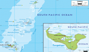
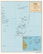
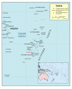
In many Polynesian languages, including Tongan, the word tonga, comes from fakatonga, which means "southwards", and the archipelago is so named because it is the southernmost group among the island groups of western Polynesia. The word tonga is cognate to the Hawaiian word "kona", meaning "leeward", which is the origin of the name for the Kona District in Hawai’i.
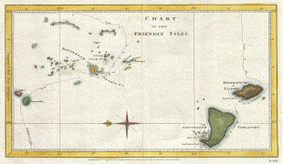
Tonga became known in the West as the "Friendly Islands" because of the congenial reception accorded to Captain James Cook on his first visit in 1773. He arrived at the time of the annual ʻinasi festival, which centres on the donation of the First Fruits to the Tuʻi Tonga (the islands' monarch), so he received an invitation to the festivities. Ironically, according to the writer William Mariner, the political leaders actually wanted to kill Cook during the gathering, but did not go through with it because they could not agree on a plan of action for accomplishing it.
Currency / Language
| ISO | Currency | Symbol | Significant figures |
|---|---|---|---|
| TOP | Tongan paʻanga | T$ | 2 |
| ISO | Language |
|---|---|
| EN | English language |
| TO | Tongan language |