Tirana County (Tirana)
Geographically, Tirana extends from the high and rugged Skanderbeg Mountains in the east to the flat shores of the Albanian Adriatic Sea Coast along the Mediterranean Sea. Due to its location and the close proximity to the Adriatic Sea, its climate is particularly influenced by a Mediterranean climate with four distinct seasons. Two of the country's fourteen National Parks are located in the county, with Dajti in the center and Divjakë-Karavasta in the southwest. Historically, Tirana has been populated since Paleolithic times dating back 10,000 to 30,000 years ago. As argued by various archaeologists, the populated places are filled with Ancient Illyrian toponyms, as its precincts are some of the earliest regions in Albania to be inhabited. Nevertheless, the city of Tirana was established as a city centuries later in 1614 during the Ottoman occupation of Albania.
The capital of the county is Tirana, which is also the largest city by area and population in Albania. A gamma-world-city, it is the most influential economic and political center of the country.
Map - Tirana County (Tirana)
Map


Country - Albania
 |
 |
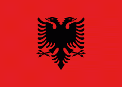
| Flag of Albania | |
Albania has been inhabited by different civilisations over time, such as the Illyrians, Thracians, Ancient Greeks, Romans, Byzantines, Venetians, and Ottomans. The Albanians established the autonomous Principality of Arbër in the 12th century. The Kingdom of Albania and Principality of Albania formed between the 13th and 14th centuries. Prior to the Ottoman conquest of Albania in the 15th century, the Albanian resistance to Ottoman expansion into Europe led by Skanderbeg won them acclaim over most of Europe. Albania remained under Ottoman rule for nearly five centuries, during which many Albanians (known as Arnauts) attained high-ranking offices in the empire, especially in the Southern Balkans and Egypt. Between the 18th and 19th centuries, cultural developments, widely attributed to Albanians having gathered both spiritual and intellectual strength, conclusively led to the Albanian Renaissance. After the defeat of the Ottomans in the Balkan Wars, the modern nation state of Albania declared independence in 1912. In the 20th century, the Kingdom of Albania was invaded by Italy, which formed Greater Albania before becoming a protectorate of Nazi Germany. Enver Hoxha formed the People's Socialist Republic of Albania after World War II, modeled under the terms of Hoxhaism. The Revolutions of 1991 concluded the fall of communism in Albania and eventually the establishment of the current Republic of Albania.
Currency / Language
| ISO | Currency | Symbol | Significant figures |
|---|---|---|---|
| ALL | Albanian lek | L | 2 |
| ISO | Language |
|---|---|
| SQ | Albanian language |
| EL | Greek language |
