Temburong District (Temburong)
Temburong District (Daerah Temburong; Jawi: دائيره تمبوروڠ ) or simply Temburong is the easternmost district in Brunei. It is an exclave — the land is separated from the rest of the country by Malaysia and Brunei Bay, and accessible from the mainland via the Sultan Haji Omar Ali Saifuddien Bridge. It has a total area of 1306 km2. The population was 10,251 in 2016; it is the least populous district in the country. Bangar is the district town and administrative centre.
The district is surrounded by Brunei Bay to the north and Sarawak, Malaysia to the east, south and west.
The Temburong River flows through the district, and the Sungai Pandaruan river forms the western section of the border with Malaysia.
The highest point is Bukit Pagon with the height of 1850 m. It is also the highest point in the country.
Brunei's first national park, the Ulu Temburong National Park, is located south of the Temburong district, covering 550 km2 of the Temburong forest. The national park has a scientific research centre facility, the Kuala Belalong Rainforest Field Studies Centre, which is only accessible by boat. 25 ha of the Kuala Belalong area had been allocated for joint venture research projects conducted by the Universiti Brunei Darussalam, Kuala Belalong Field Studies and the Smithsonian Tropical Research Institute. It is called the "Belalong Rainforest Experience," and is funded by The Hongkong and Shanghai Banking Corporation: Brunei. An Outward Bound centre can also be found within the national park.
Temburong has 67 km of roads connecting Bangar to interior villages. In addition a further 54 km of roads connect villages in the interior.
A new 30 km roadway connecting the Muara and Temburong districts of Brunei was completed in March 2020. 14 km of this roadway crosses the Brunei Bay.
Map - Temburong District (Temburong)
Map
Country - Brunei
 |
 |
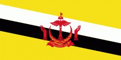
| Flag of Brunei | |
At the peak of the Bruneian Empire, Sultan Bolkiah (reigned 1485–1528) is claimed to have had control over most regions of Borneo, including modern-day Sarawak and Sabah, as well as the Sulu Archipelago off the northeast tip of Borneo, and the islands off the northwest tip of Borneo. Claims also state that they had control over Seludong (or the Kingdom of Maynila, where the modern-day Philippine capital Manila now stands) but Southeast Asian scholars believe this refers to a settlement Mount Selurong in Indonesia. The maritime state of Brunei was visited by Spain's Magellan Expedition in 1521 and fought against Spain in the 1578 Castilian War.
Currency / Language
| ISO | Currency | Symbol | Significant figures |
|---|---|---|---|
| BND | Brunei dollar | $ | 2 |
| ISO | Language |
|---|---|
| EN | English language |
| MS | Malay language |


