Taraclia
 |
The Taraclia State University, co-funded by Bulgaria and Moldova, was established in 2004. The languages of education are Bulgarian and Romanian.
According to official figures, Taraclia was founded in 1813 by Bulgarian immigrants, although they have been settling there much earlier. The city is one of the oldest Bulgarian settlements of the nineteenth century in what was then the southern Bessarabia.
The first settlers arrived at Taraclia during the Russo-Turkish war of 1806–1812. In 1821 it has settled a large group, which was originally located in the nearby village Aluatu. After the Russo-Turkish war of 1828–1829 a large proportion of Bulgarian immigrants settled in Bessarabia and specially in Taraclia, about 49 families have settled in the city. The last wave of migration happened in 1854, when 241 people settled there. Having the rights of colonists, they built houses and churches and had children, taking advantage of several decades of privileges granted to them by the Tsarist Russian government.
In the middle of the 19th century, the famous explorer Apollon Skalkowski wrote about them: "Residents, good hosts, herds of large cattle, sheep, and a great deal to the success of horticulture and viticulture, and women bred mulberry trees, collect the cocoons and have silk in large quantities"
During the interwar period, the city was the seat of Plasa Traian, in Cahul County, Romania.
Map - Taraclia
Map
Country - Moldova
 |
 |
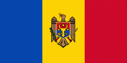
| Flag of Moldova | |
Most of Moldovan territory was a part of the Principality of Moldavia from the 14th century until 1812, when it was ceded to the Russian Empire by the Ottoman Empire (to which Moldavia was a vassal state) and became known as Bessarabia. In 1856, southern Bessarabia was returned to Moldavia, which three years later united with Wallachia to form Romania, but Russian rule was restored over the whole of the region in 1878. During the 1917 Russian Revolution, Bessarabia briefly became an autonomous state within the Russian Republic. In February 1918, it declared independence and then integrated into Romania later that year following a vote of its assembly. The decision was disputed by Soviet Russia, which in 1924 established, within the Ukrainian SSR, a so-called Moldavian autonomous republic on partially Moldovan-inhabited territories to the east of Bessarabia.
Currency / Language
| ISO | Currency | Symbol | Significant figures |
|---|---|---|---|
| MDL | Moldovan leu | L | 2 |
| ISO | Language |
|---|---|
| RO | Romanian language |
| RU | Russian language |
| TR | Turkish language |


