Talkha (Ţalkhā)
Talkha (طلخا ) is a city in Dakahlia Governorate, Egypt. The city is located on the west bank of the Damietta, a distributary of the Nile in the Delta region. Is about 120 km northeast of Cairo. Talkha is situated opposite the city of Mansoura on the Damietta. Together, the two cities form an agglomeration.
Talkha contains the neighborhoods of Old Market, El Maalamein, Ar Rouda, El Sharifa, and El Muhandisin.
Talkha is classified within the Köppen-Geiger climate classification system as a hot desert (BWh).
Talkha contains the neighborhoods of Old Market, El Maalamein, Ar Rouda, El Sharifa, and El Muhandisin.
Talkha is classified within the Köppen-Geiger climate classification system as a hot desert (BWh).
Map - Talkha (Ţalkhā)
Map


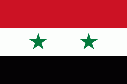
Country - United_Arab_Republic
 |
 |
| Flag of Egypt | |
The republic was led by Egyptian President Gamal Abdel Nasser. The UAR was a member of the United Arab States, a loose confederation with the Mutawakkilite Kingdom of Yemen, which was dissolved in 1961.
Currency / Language
| ISO | Currency | Symbol | Significant figures |
|---|---|---|---|
| EGP | Egyptian pound | £ or جم | 2 |
| ISO | Language |
|---|---|
| AR | Arabic language |
| EN | English language |
| FR | French language |