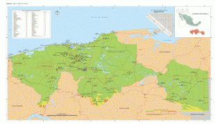
Tabasco (Estado de Tabasco)
 |
 |
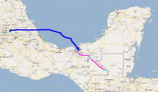
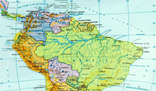
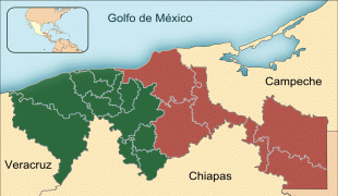
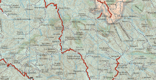
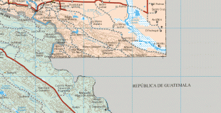
It is located in the southeast of the country, bordering the states of Campeche to the northeast, Veracruz to the west, and Chiapas to the south and the Petén department of Guatemala to the southeast. It has a coastline to the north with the Gulf of Mexico. Most of the state is covered in rainforest as, unlike most other areas of Mexico, it has plentiful rainfall year-round. The state is also home to La Venta, the major site of the Olmec civilization, considered to be the origin of later Mesoamerican cultures. It produces significant quantities of petroleum and natural gas.
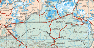
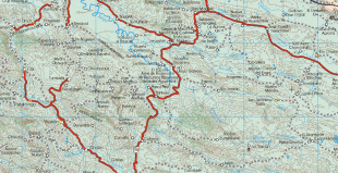
The state is located in the southeast of Mexico, bordering the states of Campeche, Chiapas, and Veracruz, with the Gulf of Mexico to the north and the country of Guatemala to the south and east. The state covers 24,731 km2, which is 1.3% of Mexico's total. The northwestern portion is on the coastal plain of the Gulf of Mexico with the south and east as part of the mountain chain that extends into northern Chiapas. It is divided into seventeen municipalities. There are 36 communities designated as urban, with about 3,000 smaller towns and villages. 185 are classified as "regional development centers". Tabasco has seventeen municipalities: Balancán, Cárdenas, Centla, Centro (Villahermosa), Comalcalco, Cunduacán, Emiliano Zapata, Huimanguillo, Jalapa, Jalpa de Méndez, Jonuta, Macuspana, Nacajuca, Paraíso, Tacotalpa, Teapa and Tenosique. In 1994, the state was officially divided into two regions and five sub-regions for socioeconomic development and geographic documentation. The two major regions are called the Grijalva and the Usumacinta. The Grijalva Region is named after the river on which most of the municipalities here are dependent. It is the smaller of the two regions with a territory of 12,069.34 km2 or 48.94% of the state's territory; however, it contains most of Tabasco's urban population as well as of its socioeconomic and political activity. It is divided into three sub-regions called Chontalpa, Centro and Sierra; it includes the municipalities of Huimanguillo, Cárdenas, Comalcalco, Cunduacán, Paraíso, Jalpa de Méndez, Nacajuca, Centro, Jalapa, Teapa and Tacotalpa. The Usumacinta Region is named after the main river on which the Centla, Jonuta, Emiliano Zapata, Balancán and Tenosique municipalities depend. It is divided into the Pantanos and Ríos subregions, which are both more rural than the Grijalva Region.
The environment of the state consists of extensive low-lying floodplains, mountains and valleys. Most of the territory is covered with tropical rainforest and wetlands. There are also areas with savanna, beaches and mangrove forests. Much of the rainforest has suffered degradation due to over-logging and conversion of territory into farmland. The east is formed of low humid plains formed by sediment deposited by a number of rivers. In the Chontalpa zone and in parts of the municipalities of Cental and Jonuta, there are swampy depressions extremely vulnerable to flooding from both riverflow and from excessive rainfall. In the south there are some elevations which are part of the central mesa of Chiapas. The most important of these is El Madrigal, La Campana, La Corona, Pomaná, Coconá, Mono Pelado and El Tortuguero. However, most hills in the state do not exceed 30 m above sea level. Tabasco has 198.8 km of shoreline, 29,800 ha of estuaries, lakes and numerous rivers and streams. Major rivers include the Mezcalapa, Pichucalco, Chacamax, Usumacinta, San Pedro y San Pablo and Tonalá. Almost all of the rivers the state belong to the Usumacinta River system, the largest in Mexico, and the Grijalva River basin, the second largest. These basins encompass numerous rivers and streams which all eventually flow into the Gulf of Mexico. The only rivers outside these basins are the Tonalá, on the border between Tabasco and Veracruz and some small rivers in Chontalpa. On the coastline, there are numerous lagoons and some inland lakes. The most important of these are El Carmen, Pajonal, La Machona and Mecoacán. Because of the flat terrain, there are areas where rivers pool due to shallow depressions. The total volume of fresh water flow in the state is about 125,000,000,000 m3, which is about 35% of the flow of the entire country. Flooding is a frequent occurrence, especially in September and November.
There are four principal ecosystems in the state: tropical rainforest, tropical savannah, beaches and wetlands. Tropical rainforest dominates most of the state due to the high levels of rainfall the area receives. However, what exists today is only a fraction of what used to be, as much of the forest area has been over-exploited by man, mostly through logging and slash-and-burn agriculture. Most of the intact rainforest is found in the municipalities of Tenosique, Balancán, Macuspana, Teapa, Tacotalpa, Cárdenas and Huimanguillo.
These rainforests contain species such as mahogany, cedar, various types of palms, "macayo", ceiba, willows and many more. There are various types of orchids native to the state along with a native species of cactus. This environment also has the widest variety of wildlife, such as macaws, parrots, quetzals, hummingbirds, iguanas, and various kinds of snakes. Mammal species have declined because of deforestation, but still include spider monkeys, jaguars, pumas, raccoons, anteaters, deer, and wild boar.
Tropical savannah is mostly found in the southern part of the state, mixed in with areas of rainforest. These areas are dominated by grasses and bushes along with some smaller trees such as jahuacte, cocoyol and small palm trees. The savannah has wildlife such as rabbits, deer, foxes, and various species of birds.
Along the coast the soil is sandier and while the vegetation is still tropical, species are different from in the interior rainforest. They include coconut palms, palo mulato, royal palm, and pimento de Tabasco. These areas have suffered the most from slash and burn agriculture.
Along these areas of forest are the beaches and wetlands of the state. The beach areas are dominated by ground vegetation which is able to tolerate the high salinity of the soil. The wetlands are dominated by the most extensive mangrove forests in Mexico, concentrated on the lagoons that border the Mezcalcpa River along with the banks of the Tonalá, San Pedro y San Pablo and Grijalva rivers. There are four main types of mangroves locally called red, white, black and "prieto". Most of the wetlands of the state belong to the Pantanos de Centla Biosphere Reserve. The abundance of fresh water in wetlands and river areas supports a wide variety of aquatic life such as freshwater gar, mojarra, crocodiles, various species of turtles and frogs, and many species of native and migratory waterfowl. In larger bodies of water manatees can be found. In the brackish and salt water lagoons various ocean species are found, as well as shellfish and mollusks, and bird species such as seagulls and pelicans.
Tabasco has a hot tropical climate, with the Gulf of Mexico having significant influence on weather patterns. Over 95% of the state's territory has a hot, wet climate. The rest is hot and semi-humid, located in the far northeast of the state. The average annual temperature is 27 C with high temperatures averaging 36 C, mostly in May, and lows of 18.5 C in January. Unlike many parts of Mexico, Tabasco has abundant year round precipitation. The state receives an average annual rainfall of 2,550 mm. Rain occurs all year but is particularly heavy from June to October. The flat areas of the state are subject to frequent flooding. One reason for this is the rivers that flow from the Sierra region and the Usuamacinta River. Another is that there are a number of dams such as the Angostura, Chicoasén, Malpas and Peñitas; these are built for hydroelectricity and flood control, but can overflow.
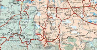
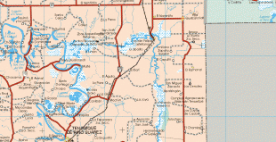
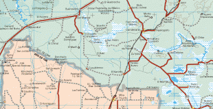
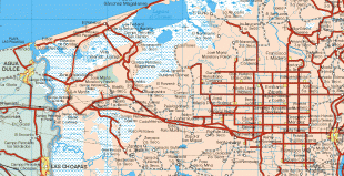
Map - Tabasco (Estado de Tabasco)
Map


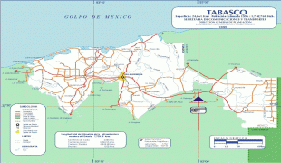


Country - Mexico


Currency / Language
| ISO | Currency | Symbol | Significant figures |
|---|---|---|---|
| MXV | Mexican Unidad de Inversion | 2 | |
| MXN | Mexican peso | $ | 2 |
| ISO | Language |
|---|---|
| ES | Spanish language |