Svit
Svit is one of the youngest Slovak towns. It was established in 1934 by business industrialist Jan Antonín Baťa of Zlín, Czechoslovakia (now Czech Republic) through his organization Baťa a.s., Zlin in accordance with his policy of setting up villages around the country for his workers. As a boy, Jan Baťa saw the poverty and sickness of his fellow countrymen. He wanted to change this by creating cities full of the most modern factories and filled with the best (and happiest) workers in Europe. The Baťa System under Jan's administration brought prosperity first to Moravia, and later Slovakia and Bohemia. It was Jan's policy for full employment that drove him to create each Baťa town for a different purpose: Shoes, Rubber and Tires, Textiles, Airplanes, Chemicals, Plastics, Media, Stockings, Leather, Machinery.
When the World War II came, Jan Baťa's policy was to secretly fund the Czechoslovak government-in-exile, to supply the Czech Army with shoes and clothing and to secretly fund the Slovak National Uprising that started at Baťovany (now Partizánske) on August 29, 1944. Jan Baťa represented Czech/Slovak freedom and prosperity.
Svit is short for "Slovenské vizkózové továrne" (in English Slovak Viscose Works). (Also, the word svit means 'shine' in Slovak) Svit is the smallest town in Slovakia (4.5 km²) with the population of 7,790.
Map - Svit
Map
Country - Slovakia
 |
 |
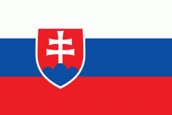
| Flag of Slovakia | |
The Slavs arrived in the territory of present-day Slovakia in the fifth and sixth centuries. In the seventh century, they played a significant role in the creation of Samo's Empire. In the ninth century, they established the Principality of Nitra, which was later conquered by the Principality of Moravia to establish Great Moravia. In the 10th century, after the dissolution of Great Moravia, the territory was integrated into the Principality of Hungary, which then became the Kingdom of Hungary in 1000. In 1241 and 1242, after the Mongol invasion of Europe, much of the territory was destroyed. The area was recovered largely thanks to Béla IV of Hungary, who also settled Germans, leading them to become an important ethnic group in the area, especially in what are today parts of central and eastern Slovakia.
Currency / Language
| ISO | Currency | Symbol | Significant figures |
|---|---|---|---|
| EUR | Euro | € | 2 |
| ISO | Language |
|---|---|
| HU | Hungarian language |
| SK | Slovak language |


