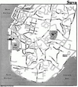
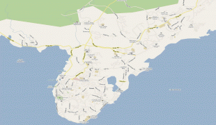
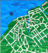
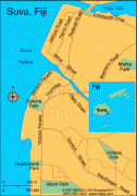
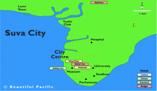
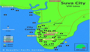
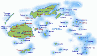
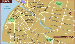
Suva
 |
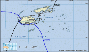
In 1877, the capital of Fiji was moved to Suva from Levuka, the main European colonial settlement at the time, due to its restrictive geography and environs. The administration of the colony was transferred from Levuka to Suva in 1882.
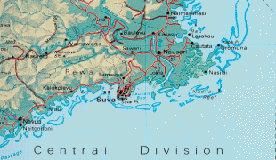
As of the 2017 census, the city of Suva had a population of 93,970, and Suva's metropolitan area, which includes its independent suburbs, had a population of 185,913. The combined urban population of Suva and the towns of Lami, Nasinu, and Nausori that border it was around 330,000: over a third of the nation's population. (This urban complex, excluding Lami, is also known as the Suva-Nausori corridor.)
Suva is the political, economic, and cultural centre of Fiji. It is also the economic and cultural capital of the South Pacific, hosting the majority of the regional headquarters of major international corporations, international agencies, and diplomatic missions. The city also has a thriving arts and performance scene, and a growing reputation as the region's fashion capital.
In 1868, when Suva was still a small village, the Bauan chieftain, Seru Epenisa Cakobau, granted 5000 km2 of land to the Australian-based Polynesia Company, in exchange for the company's promise to pay off debts owed to the United States. More than a tenth of this land area, 575 km2, was located near Suva. The company's original intention was to develop a cotton farming industry, but the land and climate proved unsuitable.
In 1874, control of the Fiji Islands was ceded to the United Kingdom. In 1877, the colonial authorities decided to move the capital to Suva from Levuka, Ovalau, Lomaiviti, because Levuka's location between a steep mountain and the sea made any expansion of the town impractical. Colonel F.E. Pratt of the Royal Engineers was appointed Surveyor-General in 1875 and designed the new capital in Suva, assisted by W. Stephens and Colonel R.W. Stewart. The transfer to Suva was made official in 1882.
In 1910, Suva acquired the status of a municipality, under the Municipal Constitution Ordinance of 1909. Its area remained one square mile until 1952 when Suva annexed the Muanikau and Samabula wards, expanding its territory to 13 km2. In October of that year, Suva was officially designated a city – Fiji's first. Suva later annexed Tamavua. Most recently, Suva further extended its boundaries by incorporating the Cunningham area at its northern edge. Since then, urban sprawl has led to the growth of a number of suburbs that remain outside the city limits. Together with the city, they form the metropolitan area known as the Greater Suva Area.
Suva hosted the South Pacific Games in 2003 for the third time in the event's 40-year history. In preparation for hosting the event, the Fijian government, with the help of a $16 million aid package from the People's Republic of China, funded the construction of a new gymnasium, indoor sports centre, swimming pool, stadium, field hockey pitch, and grandstands in the area around Suva.
Map - Suva
Map


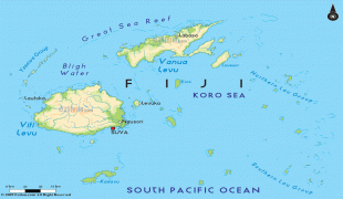
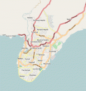

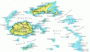
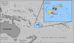
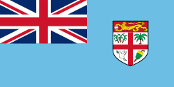
Country - Fiji
 |
 |
| Flag of Fiji | |
The majority of Fiji's islands were formed by volcanic activity starting around 150 million years ago. Some geothermal activity still occurs today on the islands of Vanua Levu and Taveuni. The geothermal systems on Viti Levu are non-volcanic in origin and have low-temperature surface discharges (of between roughly 35 and 60 C).
Currency / Language
| ISO | Currency | Symbol | Significant figures |
|---|---|---|---|
| FJD | Fijian dollar | $ | 2 |
| ISO | Language |
|---|---|
| EN | English language |
| FJ | Fijian language |