Southern Red Sea Region (Southern Red Sea Region)
As of 2005, the region had a population of 83,500 compared to a population of 73,700 in 2001. The net growth rate was 11.74 per cent. The total area of the province was 27600.00 km2 and the density was 3.03 persons per km2.
The Southern Red Sea Region extends over 500 km along Red Sea coast but is only around 50 km wide. Forming the major part of the Danakil Desert, its major towns include Asseb, Beilul, Rahaita and T'i'o. The highest point in this region is Mount Ramlu (2248 m). It is generally considered one of the hottest, driest and most inhospitable regions in the country. The topography of the region has coastal plains, which are hotter than the regions around the highland plateau. There are two rainy seasons, the heavier one during summer and the lighter one during spring. The climate and geography of the region along with other regions of Eritrea is similar to the one of Ethiopia. The hottest month is May recording temperatures up to 30 °C, while the coldest month is December to February when it reaches freezing temperature. The region received around 200 mm of rainfall and the soil is salty and not conducive for agriculture.
Wildlife such as hamadryas baboons, Soemmerring's gazelle, dorcas gazelle, warthog, black-backed jackal, Ruppells sandfox, dikdik, African golden wolf, hyena, Abyssinian hare, wild ass and ostriches are found in this region. African wild dog was also found in this region, but their present condition is unknown. There have been reports of cheetah occurring in this region, but there has been no evidence of their presence. It is extremely likely that both cheetah and wild dog are extinct in Eritrea.
Map - Southern Red Sea Region (Southern Red Sea Region)
Map


Country - Eritrea
 |
 |
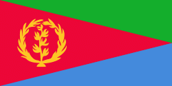
| Flag of Eritrea | |
Human remains found in Eritrea have been dated to 1 million years old and anthropological research indicates that the area may contain significant records related to the evolution of humans. Contemporary Eritrea is a multi-ethnic country with nine recognised ethnic groups. Nine different languages are spoken by the nine recognised ethnic groups, the most widely spoken language being Tigrinya, the others being Tigre, Saho, Kunama, Nara, Afar, Beja, Bilen and Arabic. Tigrinya, Arabic, and English serve as the three working languages. Most residents speak languages from the Afroasiatic family, either of the Ethiopian Semitic languages or Cushitic branches. Among these communities, the Tigrinyas make up about 55% of the population, with the Tigre people constituting around 30% of inhabitants. In addition, there are several Nilo-Saharan-speaking Nilotic ethnic groups. Most people in the country adhere to Christianity or Islam, with a small minority adhering to traditional faiths.
Currency / Language
| ISO | Currency | Symbol | Significant figures |
|---|---|---|---|
| ERN | Eritrean nakfa | Nfk | 2 |
| ISO | Language |
|---|---|
| AA | Afar language |
| AR | Arabic language |
| TI | Tigrinya language |