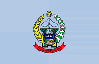
South Sulawesi (Provinsi Sulawesi Selatan)
 |
 |
The 2010 census estimated the population as 8,032,551 which makes South Sulawesi the most populous province on the island (46% of the population of Sulawesi is in South Sulawesi), and the sixth most populous province in Indonesia. At the 2020 Census this had risen to 9,073,509, and the official estimate as at mid 2021 was 9,139,531. The main ethnic groups in South Sulawesi are the Buginese, Makassarese, Toraja, and Mandar. The economy of the province is based on agriculture, fishing, and mining of gold, magnesium, iron and other metals. The pinisi, a traditional Indonesian two-masted sailing ship, is still used widely by the Buginese and Makassarese, mostly for inter-insular transportation, cargo, and fishing purposes within the Indonesian archipelago.
During the golden era of the spice trade, from the 15th to 19th centuries, South Sulawesi served as the gateway to the Maluku Islands. There were a number of small kingdoms, including two prominent ones, the Kingdom of Gowa near Makassar and the Bugis kingdom located in Bone. The Dutch East India Company (VOC) began operating in the region in the 17th century. VOC later allied with the Bugis prince, Arung Palakka, and they defeated the kingdom of Gowa. The king of Gowa, Sultan Hasanuddin was forced to sign a treaty which greatly reduced the power of Bungaya Gowa.
Sulawesi was first inhabited by humans about 30,000 years ago. The archaeological remains of the earliest inhabitants were discovered in caves near limestone hills around Maros, about 30 km northeast of Makassar, the capital of the South Sulawesi province. Pebble and flake stone tools have been collected from the river terraces in the valley of Walanae, among Soppeng and Sengkang, including the bones from giant pig and elephant species that are now extinct. Hand print paintings, estimated to be around 35,000 to 40,000 years old, have been found in the Pettakere cave, located 12 km from the town of Maros and 30 km from Makassar.
Increase in commerce due to the rise of external demand for South Sulawesi rice encouraged major agricultural expansion and political centralization in the early 14th century. Swidden agriculture was increasingly replaced with intensive wet rice cultivation, leading to a rise in population density. New settlements were founded in the interior part of the peninsula as pristine forests were cleared. These changes accompanied the rise of new interior agricultural polities, such as the Bugis chiefdoms of Boné and Wajoq, as well as the Makassar polity of Gowa.
By the early 16th century, Boné had assumed a paramount position in the eastern part of the peninsula, while Makassar twin kingdoms of Gowa and Talloq started to expand their influence throughout the western part. Their competition for hegemony over South Sulawesi made Gowa-Talloq and Boné clashed against each other in the 1560s.
In 1582, three Bugis polities, Boné, Soppéng, and Wajoq signed a mutual defense pact known as the Treaty of Timurung. The alliance, also referred to as the Tellumpocco ("Three Powers", lit. "Three Peaks"), sought to stop Gowa's expansionism and to reclaim the autonomy of the Bugis polities under Gowa's vassalage. Gowa's campaigns against the alliance in 1582, 1585, and 1588 were all successfully repulsed, with another one in 1590 abandoned following the death of Gowa's ruler. By the early 17th century, however, Gowa and Talloq had become the most dominant powers in South Sulawesi as they supported international commerce and embracing the new faith of Islam. Gowa waged successful campaigns against Bugis kingdoms, defeating Soppéng in 1609, Wajoq in 1610, and Boné in 1611.
Dutch East India Company began operating in the region in the 17th century and saw the Kingdom of Gowa as an obstacle to its desire for control of the spice trade in this area. VOC later allied with the Bugis prince, Arung Palakka, who was living in exile after the fall of the Bugis. After a year-long battle, they defeated the kingdom of Gowa. And the king of Gowa, Sultan Hasanuddin was forced to sign a treaty which greatly reduced the power of Bungaya Gowa. Furthermore, Palakka became ruler in South Sulawesi.
A Bugis queen later emerged to lead the resistance against the Dutch, who were busy dealing with the Napoleonic Wars in Europe. Yet once past the Napoleonic Wars, the Dutch returned to South Sulawesi and eradicated the queen's rebellion. But resistance of the Bugis people against colonial rule continued until 1905. In 1905, the Dutch also managed to conquer Tana Toraja.
Before the proclamation of the Republic of Indonesia, South Sulawesi consisted of a number of independent kingdoms' territory and was inhabited by four ethnic groups namely the Bugis, Makassar, Mandar, and Toraja.
Map - South Sulawesi (Provinsi Sulawesi Selatan)
Map
Country - Indonesia
 |
 |
| Flag of Indonesia | |
As the world's third largest democracy, Indonesia is a presidential republic with an elected legislature. It has 38 provinces, of which nine have special status. The country's capital, Jakarta, is the world's second-most populous urban area. Indonesia shares land borders with Papua New Guinea, East Timor, and the eastern part of Malaysia, as well as maritime borders with Singapore, Vietnam, Thailand, the Philippines, Australia, Palau, and India. Despite its large population and densely populated regions, Indonesia has vast areas of wilderness that support one of the world's highest level of biodiversity.
Currency / Language
| ISO | Currency | Symbol | Significant figures |
|---|---|---|---|
| IDR | Indonesian rupiah | Rp | 2 |
| ISO | Language |
|---|---|
| NL | Dutch language |
| EN | English language |
| ID | Indonesian language |
| JV | Javanese language |


