Sottunga
 |
Sottunga can be reached by ferry from Långnäs in Lumparland and Galtby in Korpo and many ferries pass the island without making a stop.
Like the rest of Eastern Åland, Sottunga got its first permanent inhabitants sometime in the 11th century, although there is evidence that the island had had inhabitants long before that. The name Sottunga itself is thought to predate the 11th century. In the 17th century there were some ten households on the island and about 70 inhabitants.
Sottunga has suffered during many wars, first during the Great Northern War in 1714–22 when all of Åland fled to Sweden and again during the Finnish War of 1808-09 when all the buildings on the island were set on fire in order to prevent them from falling into enemy hands. In 1800, before the Finnish War, the island had been visited by King Gustav IV Adolf of Sweden. Later during the Winter War of 1939–40 the island was bombed by the Soviet Union. The bombs were responsible for the sinking of the cargo ship SS Notung in 1940 just northeast of Sottunga.
The population of Sottunga reached its peak in the 1920s with about 400 inhabitants from which it has gradually declined during the 20th century.
Map - Sottunga
Map


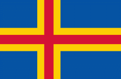
Country - Åland_Islands
 |
 |
Åland is situated in an archipelago, called the Åland Islands, at the entrance to the Gulf of Bothnia in the Baltic Sea belonging to Finland. It comprises Fasta Åland on which 90% of the population resides and about 6,500 skerries and islands to its east. Of Åland's thousands of islands, about 60–80 are inhabited. Fasta Åland is separated from the coast of Roslagen in Sweden by 38 km of open water to the west. In the east, the Åland archipelago is contiguous with the Finnish archipelago. Åland's only land border is located on the uninhabited skerry of Märket, which it shares with Sweden. From Mariehamn, there is a ferry distance of about 160 km to Turku, a coastal city of mainland Finland, and also to Stockholm, the capital of Sweden.
Currency / Language
| ISO | Currency | Symbol | Significant figures |
|---|---|---|---|
| EUR | Euro | € | 2 |
| ISO | Language |
|---|---|
| SV | Swedish language |
