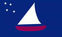
Sonsorol (State of Sonsorol)
 |
The islands of the state of Sonsorol, together with the islands of Hatohobei, form the Southwest Islands of Palau.
The first sighting by Europeans of the Sonsorols, was that of Sonsorol and Fanna by the Spanish ship Trinidad then commanded by Gonzalo Gómez de Espinosa on 6 May 1522. These two were collectively charted as San Juan islands (St.John) as they were sighted on the day of its festivity. A Spanish missionary expedition commanded by Sargento Mayor Francisco Padilla arrived to Sonsorol on 30 November 1710, coming from Manila on board of patache Santísima Trinidad. In 1712 they were explored by an expedition commanded by Spanish naval officer Bernardo de Egoy.
In 1899 Spain decided to sell the islands to Germany, which lost control over the territory in World War I, when Japan took over. The United States took possession of the area at the end of the World War II until Palau's independence.
During December 2012, the state suffered severely from Typhoon Bopha and people were evacuated to Akebesang in Koror. There were 37 people from Sonsorol, 19 from Pulo Anna and 2 from Merir. A couple of months later, and due to government decision, only Sonsorol was re-inhabited (cheaper and closer to get to and send supplies). 42 people have returned to the island, and it is the only inhabited island in the state (as of 2014).
Map - Sonsorol (State of Sonsorol)
Map


Country - Palau
 |
 |
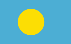
| Flag of Palau | |
The country was originally settled approximately 3,000 years ago by migrants from Maritime Southeast Asia. Palau was first drawn on a European map by the German missionary Paul Klein based on a description given by a group of Palauans shipwrecked on the Philippine coast on Samar. Palau islands were made part of the Spanish East Indies in 1885. Following Spain's defeat in the Spanish–American War in 1898, the islands were sold to Germany in 1899 under the terms of the German–Spanish Treaty, where they were administered as part of German New Guinea. After World War I, the islands were made a part of the Japanese-ruled South Seas Mandate by the League of Nations. During World War II, skirmishes, including the major Battle of Peleliu, were fought between American and Japanese troops as part of the Mariana and Palau Islands campaign. Along with other Pacific Islands, Palau was made a part of the United States-governed Trust Territory of the Pacific Islands in 1947. Having voted in a referendum against joining the Federated States of Micronesia in 1978, the islands gained full sovereignty in 1994 under a Compact of Free Association with the United States.
Currency / Language
| ISO | Currency | Symbol | Significant figures |
|---|---|---|---|
| USD | United States dollar | $ | 2 |
| ISO | Language |
|---|---|
| ZH | Chinese language |
| EN | English language |
| JA | Japanese language |