Slovakia (Slovak Republic)
 |
 |
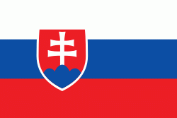
| Flag of Slovakia | |
The Slavs arrived in the territory of present-day Slovakia in the fifth and sixth centuries. In the seventh century, they played a significant role in the creation of Samo's Empire. In the ninth century, they established the Principality of Nitra, which was later conquered by the Principality of Moravia to establish Great Moravia. In the 10th century, after the dissolution of Great Moravia, the territory was integrated into the Principality of Hungary, which then became the Kingdom of Hungary in 1000. In 1241 and 1242, after the Mongol invasion of Europe, much of the territory was destroyed. The area was recovered largely thanks to Béla IV of Hungary, who also settled Germans, leading them to become an important ethnic group in the area, especially in what are today parts of central and eastern Slovakia.
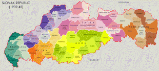
After World War I and the dissolution of the Austro-Hungarian Empire, the state of Czechoslovakia was established. It was the only country in central and eastern Europe to remain a democracy during the interwar period. Nevertheless, local fascist parties gradually came to power in the Slovak lands, and the first Slovak Republic existed during World War II as a partially-recognised client state of Nazi Germany. At the end of World War II, Czechoslovakia was re-established as an independent country. After a coup in 1948, Czechoslovakia came under communist administration, and became a part of the Soviet-led Eastern Bloc. Attempts to liberalise communism in Czechoslovakia culminated in the Prague Spring, which was crushed by the Warsaw Pact invasion of Czechoslovakia in August 1968. In 1989, the Velvet Revolution peacefully ended the Communist rule in Czechoslovakia. Slovakia became an independent state on 1 January 1993 after the peaceful dissolution of Czechoslovakia, sometimes known as the Velvet Divorce.
Slovakia is a developed country with an advanced high-income economy, ranking 45th very high in the Human Development Index. It also performs favourably in measurements of civil liberties, press freedom, internet freedom, democratic governance, and peacefulness. The country maintains a combination of a market economy with a comprehensive social security system, providing citizens with universal health care, free education, and one of the longest paid parental leaves in the OECD. Slovakia is a member of the European Union, the Eurozone, the Schengen Area, the United Nations, NATO, CERN, the OECD, the WTO, the Council of Europe, the Visegrád Group, and the OSCE. Slovakia is also home to eight UNESCO World Heritage Sites. The world's largest per-capita car producer, Slovakia manufactured a total of 1.1 million cars in 2019, representing 43% of its total industrial output.
Slovakia's name in theory means the "Land of the Slavs" (Slovensko in Slovak stemming from the older form Sloven/Slovienin). As such, it is a cognate of the words Slovenia and Slavonia. In medieval Latin, German, and even some Slavic sources, the same name has often been used for Slovaks, Slovenes, Slavonians, and Slavs in general. According to one of the theories, a new form of national name formed for the ancestors of the Slovaks between the 13th and 14th century, possibly due to foreign influence; the Czech word Slovák (in medieval sources from 1291 onward). This form slowly replaced the name for the male members of the community, but the female name (Slovenka), reference to the lands inhabited (Slovensko) and the name of the language (slovenčina) all remained the same, with their base in the older form (compare to Slovenian counterparts). Most foreign translations tend to stem from this newer form (Slovakia in English, Slowakei in German, Slovaquie in French, etc.).
In medieval Latin sources, terms Slavus, Slavonia, or Slavorum (and more variants, from as early as 1029) have been used. In German sources, names for the Slovak lands were Windenland or Windische Lande (early 15th century), with the forms "Slovakia" and "Schlowakei" starting to appear in the 16th century. The present Slovak form Slovensko is first attested in the year 1675.
Currency / Language
| ISO | Currency | Symbol | Significant figures |
|---|---|---|---|
| EUR | Euro | € | 2 |
| ISO | Language |
|---|---|
| HU | Hungarian language |
| SK | Slovak language |


