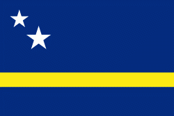
Curaçao ( ; Kòrsou, ), officially the Country of Curaçao (Land Curaçao; Pais Kòrsou), is a Lesser Antilles island country in the southern Caribbean Sea and the Dutch Caribbean region, about 65 km north of the Venezuela coast. It is a constituent country of the Kingdom of the Netherlands. Together with Aruba and Bonaire, it forms the ABC islands. Collectively, Curaçao, Aruba, and other Dutch islands in the Caribbean are often called the Dutch Caribbean. It is the largest of the ABC islands in both area and population as well as the largest of the Dutch Caribbean.
Curaçao was formerly part of the Curaçao and Dependencies colony from 1815 to 1954 and later the Netherlands Antilles from 1954 to 2010, as Island Territory of Curaçao (Eilandgebied Curaçao, Teritorio Insular di Kòrsou), and is now formally called the Country of Curaçao. It includes the main island of Curaçao and the much smaller, uninhabited island of Klein Curaçao ("Little Curaçao"). Curaçao has a population of 158,665 (January 2019 est.), with an area of 444 km2; its capital is Willemstad.