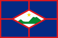
Sint Eustatius (Sint Eustatius)
 |
 |
The island lies in the northern Leeward Islands portion of the West Indies, southeast of the Virgin Islands. Sint Eustatius is immediately to the northwest of Saint Kitts, and to the southeast of Saba. The regional capital is Oranjestad. The island has an area of 21 km2. Travellers to the island by air arrive through F. D. Roosevelt Airport. Formerly part of the Netherlands Antilles, Sint Eustatius became a public body of the Netherlands on 10 October 2010. Together with Bonaire and Saba it forms the Caribbean Netherlands (not to be confused with Dutch Caribbean which also includes Curaçao, Aruba, and Sint Maarten).
The name of the island, "Sint Eustatius", is the Dutch name for Saint Eustace (also spelled Eustachius or Eustathius), a legendary Christian martyr, known in Spanish as San Eustaquio and in Portuguese as Santo Eustáquio or Santo Eustácio. The indigenous name for the island is Aloi meaning cashew tree (origin Arawak).
The earliest inhabitants were Caribs believed to have come from the Amazon basin (South America) and migrated north from Venezuela via the Lesser Antilles. In the early 20th century, settlement traces were discovered at Golden Rock and Orange Bay.
Multiple pre-Columbian sites have been found on the island, most notably the site referred to as the "Golden Rock Site". It is thought that the island was likely seen by Christopher Columbus in 1493. From the first European settlement, in the 17th century up until the early 19th century, St. Eustatius changed hands twenty-one times between the Netherlands, Britain, and France.
In 1636, the chamber of Zeeland of the Dutch West India Company took possession of the island, reported to be uninhabited at the time. In 1678 the islands of St. Eustatius, Sint Maarten and Saba were under the direct command of the Dutch West India Company, with a commander stationed on St. Eustatius to govern all three. At the time, the island was of some importance for the cultivation of tobacco and sugar. More important was the role of St. Eustatius in the trans-Atlantic slave trade and the intercolonial slave trade.
Map - Sint Eustatius (Sint Eustatius)
Map
Country - Caribbean_Netherlands
 |
 |
Bonaire (including the islet of Klein Bonaire) is one of the Leeward Antilles and is located close to the coast of Venezuela. Sint Eustatius and Saba are in the main Lesser Antilles group and are located south of Sint Maarten and northwest of Saint Kitts and Nevis. The Caribbean Netherlands has a population of 25,157 as of January 2019.
Currency / Language
| ISO | Currency | Symbol | Significant figures |
|---|---|---|---|
| USD | United States dollar | $ | 2 |
| ISO | Language |
|---|---|
| NL | Dutch language |
| EN | English language |


