Shkodër County (Qarku i Shkodrës)
During the Bronze Age, the area was inhabited by various Illyrian tribes such as the Ardiaeis and Labeataes. Illyria was annexed by Rome in the second century BC, becoming an integral part of the Roman Empire and its successor the Byzantine Empire. Falling under Venetian and Ottoman dominion in the late Middle Ages, the modern nation state of Albania emerged in 1912 following its independence.
The climate of the county is profoundly affected by the Adriatic Sea in the west and the Albanian Alps in the north. It experiences mostly mediterranean climate, while the north enjoys continental climate. The summers are predominantly hot and dry, the winters relatively mild, and falls and springs mainly unstable, both in terms of precipitation and temperatures. Heavy rainfall is extremely common in the county and has caused many floodings of the rivers and lakes.
The county features notable diversity with the landscape ranging from the snow-capped Albanian Alps in the north to the warm regions of Shkodra Lake and Adriatic Sea in the south and southwest. Being a geological continuation of the Dinaric Alps, the Albanian Alps are the highest section and one of the most rugged mountains in Europe. While the Alps occupy the northern part of the territory, the population is concentrated mostly on the Mbishkodra plain, where the largest city is to be found, the cultural and economic centre of Shkodër. The mountainous areas of the county is sparsely populated, where the population density falls. The largest lake of Southern and Southeastern Europe, the Lake Shkodër sprawls in the east and is shared with Montenegro.
With more than 215,000 inhabitants in 2016, the county is the sixth most populous county in Albania, the second most populous county in the Northern Region. The county is ethnically a homogeneous county and mostly inhabited by Gheg Albanians. In addition, Egyptians, Montenegrins and Greeks also are present in the ethnic composition of the local population. The country has no official religion and freedom of religion is a right defined by the Constitution of Albania, and the most widely professed religion in the county is Islam and Christianity.
Shkodër is one of 12 counties of Albania, located in the west of the Northern Region. It lies between latitudes 42° N, and longitudes 20° E. The county area is 3562 km2 and the second largest county by area in Albania and the largest in the Northern Region. It is limited to the counties of Kukës to the northeast and east, Lezhë to the southeast and south, the country of Montenegro in the north and the Adriatic Sea in the southwest.
The county has a wide variety of topographical sets and natural landscapes. The Albanian Alps, which extends in the north of the county toward Montenegro, is a primarily mountainous region with a high terrain. The alps delineated several sedimentary basins such as the Mbishkodra basin in the center. The highest point in the county is Maja Jezercë at 2694 m above the Adriatic in the northeast shared with Kukës County. The lowest spot is 0 m above the Adriatic, located in the southwest of the county.
Due to the considerable variation in altitude, it makes for a wide range of climate types. The Adriatic Sea in the west and Albanian Alps in the north have a great influence to the climate of the county. Most of the county has a usually rainy and hot mediterranean climate as defined by the Köppen climate classification. Mean monthly temperature ranges between -2 °C in January and 25 °C in August. The mean annual precipitation ranges between 1800 mm and 300 mm depending on longitude and latitude and prevailing climate type.
Map - Shkodër County (Qarku i Shkodrës)
Map


Country - Albania
 |
 |
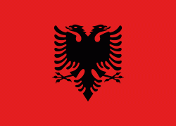
| Flag of Albania | |
Albania has been inhabited by different civilisations over time, such as the Illyrians, Thracians, Ancient Greeks, Romans, Byzantines, Venetians, and Ottomans. The Albanians established the autonomous Principality of Arbër in the 12th century. The Kingdom of Albania and Principality of Albania formed between the 13th and 14th centuries. Prior to the Ottoman conquest of Albania in the 15th century, the Albanian resistance to Ottoman expansion into Europe led by Skanderbeg won them acclaim over most of Europe. Albania remained under Ottoman rule for nearly five centuries, during which many Albanians (known as Arnauts) attained high-ranking offices in the empire, especially in the Southern Balkans and Egypt. Between the 18th and 19th centuries, cultural developments, widely attributed to Albanians having gathered both spiritual and intellectual strength, conclusively led to the Albanian Renaissance. After the defeat of the Ottomans in the Balkan Wars, the modern nation state of Albania declared independence in 1912. In the 20th century, the Kingdom of Albania was invaded by Italy, which formed Greater Albania before becoming a protectorate of Nazi Germany. Enver Hoxha formed the People's Socialist Republic of Albania after World War II, modeled under the terms of Hoxhaism. The Revolutions of 1991 concluded the fall of communism in Albania and eventually the establishment of the current Republic of Albania.
Currency / Language
| ISO | Currency | Symbol | Significant figures |
|---|---|---|---|
| ALL | Albanian lek | L | 2 |
| ISO | Language |
|---|---|
| SQ | Albanian language |
| EL | Greek language |
