Shida Kartli (Shida Kartli)
The region is bordered by the Russian Federation to the north, Georgian regions of Mtskheta-Mtianeti to the east, Kvemo Kartli to the south, Samtskhe-Javakheti to the southwest, Imereti to the west, and Racha-Lechkhumi and Kvemo Svaneti to the northwest. It consists of the following municipalities: Gori, Kaspi, Kareli, Java, Khashuri.
The northern part of the region, namely Java, and northern territories of Kareli and Gori municipalities (total area of 1,393 km²), have been controlled by the authorities of the self-proclaimed Republic of South Ossetia since 1992 and occupied by Russian troops since 2008 Russo-Georgian war.
The name Shida Kartli in English translates as Inner Kartli. The term Kartli itself derives from Proto-Kartvelian root *kart- ("Georgian"), which is considered an ancient inner-Kartvelian formation by modern linguists.
Map - Shida Kartli (Shida Kartli)
Map
Country - Georgia_(country)
 |
 |
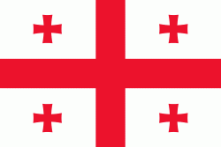
| Flag of Georgia (country) | |
During the classical era, several independent kingdoms became established in what is now Georgia, such as Colchis and Iberia. In the early 4th century, ethnic Georgians officially adopted Christianity, which contributed to the spiritual and political unification of the early Georgian states. In the Middle Ages, the unified Kingdom of Georgia emerged and reached its Golden Age during the reign of King David IV and Queen Tamar in the 12th and early 13th centuries. Thereafter, the kingdom declined and eventually disintegrated under the hegemony of various regional powers, including the Mongols, the Turks, and various dynasties of Persia. In 1783, one of the Georgian kingdoms entered into an alliance with the Russian Empire, which proceeded to annex the territory of modern Georgia in a piecemeal fashion throughout the 19th century.
Currency / Language
| ISO | Currency | Symbol | Significant figures |
|---|---|---|---|
| GEL | Georgian lari | ₾ | 2 |
| ISO | Language |
|---|---|
| HY | Armenian language |
| AZ | Azerbaijani language |
| KA | Georgian language |
| RU | Russian language |


