Savaneta
Savaneta is a town and region in southeastern Aruba. Until 1797, it was the island's capital city. It is home to the island's oldest surviving home, a 150-year-old cas di torto, or mud hut. The Savaneta region has an estimated area of 27.76 square kilometers and 11,518 inhabitants according to the 2010 census.
Savaneta is the oldest village of Aruba. In the 16th century, it became the capital of the Spanish administration. After Aruba was conquered by the Netherlands, the governor lived in Commander's Bay, a natural harbour near Savaneta. In 1797, the government moved to Paardenbaai which would later become Oranjestad. By 1816, only one house had remained inhabited. In 1852, the Canashito plantation was established, and workers were exempt for taxation for eight years. Still only 13 men and 5 boys moved to Savaneta that year. Other plantations were more successful, and by 1867, Savaneta was recognised as a village. It was home to about 150 people. In 1877, a school was founded and in 1900 a church was built. Commander's Bay is nowadays used as the Marine Barracks Savaneta, a base for the Royal Netherlands Navy, the Netherlands Marine Corps, the Netherlands Coastguard, and the Aruban Military.
Savaneta is the oldest village of Aruba. In the 16th century, it became the capital of the Spanish administration. After Aruba was conquered by the Netherlands, the governor lived in Commander's Bay, a natural harbour near Savaneta. In 1797, the government moved to Paardenbaai which would later become Oranjestad. By 1816, only one house had remained inhabited. In 1852, the Canashito plantation was established, and workers were exempt for taxation for eight years. Still only 13 men and 5 boys moved to Savaneta that year. Other plantations were more successful, and by 1867, Savaneta was recognised as a village. It was home to about 150 people. In 1877, a school was founded and in 1900 a church was built. Commander's Bay is nowadays used as the Marine Barracks Savaneta, a base for the Royal Netherlands Navy, the Netherlands Marine Corps, the Netherlands Coastguard, and the Aruban Military.
Map - Savaneta
Map


Country - Aruba
 |
 |
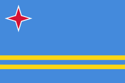
Aruba is one of the four countries that form the Kingdom of the Netherlands, along with the Netherlands, Curaçao, and Sint Maarten; the citizens of these countries are all Dutch nationals. Aruba has no administrative subdivisions, but, for census purposes, is divided into eight regions. Its capital is Oranjestad. Unlike much of the Caribbean region, Aruba has a dry climate and an arid, cactus-strewn landscape. The relatively warm and sunny weather, and the climate allow for related tourism activities all year round. Its area is 179 km2 and it is quite densely populated, with 108,166 inhabitants per the 2020 census.
Currency / Language
| ISO | Currency | Symbol | Significant figures |
|---|---|---|---|
| AWG | Aruban florin | Æ’ | 2 |
| ISO | Language |
|---|---|
| NL | Dutch language |
| EN | English language |
| ES | Spanish language |