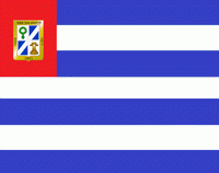
San Salvador Department (Departamento de San Salvador)
 |
 |
* Largest city: San Salvador
* Smallest city: Rosario de Mora
* 1) Aguilares
* 2) Apopa
* 3) Ayutuxtepeque
* 4) Cuscatancingo
* 5) Delgado
* 6) El Paisnal
* 7) Guazapa
Map - San Salvador Department (Departamento de San Salvador)
Map


Country - El_Salvador
 |
 |
| Flag of El Salvador | |
Among the Mesoamerican nations that historically controlled the region are the Lenca (after 600 AD), the Mayans, and then the Cuzcatlecs. Archaeological monuments also suggest an early Olmec presence around the first millennium BC. In the beginning of the 16th century, the Spanish Empire conquered the Central American territory, incorporating it into the Viceroyalty of New Spain ruled from Mexico City. However the Viceroyalty of New Spain had little to no influence in the daily affairs of the isthmus, which was colonized in 1524. In 1609, the area was declared the Captaincy General of Guatemala by the Spanish, which included the territory that would become El Salvador until its independence from Spain in 1821. It was forcibly incorporated into the First Mexican Empire, then seceded, joining the Federal Republic of Central America in 1823. When the federation dissolved in 1841, El Salvador became a sovereign state, then formed a short-lived union with Honduras and Nicaragua called the Greater Republic of Central America, which lasted from 1895 to 1898.
Currency / Language
| ISO | Currency | Symbol | Significant figures |
|---|---|---|---|
| SVC | Salvadoran colón | 2 | |
| USD | United States dollar | $ | 2 |
| ISO | Language |
|---|---|
| ES | Spanish language |
