San Francisco de Macorís (San Francisco de Macorís)
 |
The city is known as the Land of Cacao ("Tierra del Cacao"). It the location of the area in the world where the greatest amount of organic cocoa is produced, which in turn makes the Dominican Republic the biggest producer and exporter nation of this product. It also makes the Dominican Republic the 10th biggest producer of chocolate cacao beans in the world
The city founded near San Francisco de Macorís was founded in 1497. After the Vega was founded, Cotuí was later established in 1505 in a place rich in gold. For centuries what is now San Francisco de Macorís and the Duarte Province was rural outskirts of La Vega and Cotuí respectively. By the beginning of the 18th century, foreign investment from Europeans created a market for the production of cocoa, allowing the locals to gain a new source of income apart from livestock. It was the cocoa market that allowed the community around the Santa Ana monastery to become San Francisco de Macorís. However, it wasn't until the 1760s that the province gained a monopoly on the cocoa industry or managing to become a town for European travelers to stop by. The Villa of Santa Ana of San Francisco de Macorís also previously called Hato Grande, was named this until it was owned by Francisco Ravelo Polanco, Provincial Mayor of the Santa Hermandad of Santiago de los Caballeros, and later the tradition points out to Juan de Alvarado and the families Tejada and De Jesus as the owners of the land and donors of the territorial area for the purpose of its foundation in 1778.
In 1795, the Treaty of Basel was ratified, ceding to France the Spanish territory of Hispaniola. France took over the Spanish side in 1801, and under its administration San Francisco de Macorís is conceived became a parish with self-government. The official minutes of the city date back to 1811. On October 2, 1896, Ulises Heureaux reorganized the city of San Francisco de Macorís under Provincial District "Pacificador" (Peacemaker). At that time it was assigned as common to Cantonal Position of Matanzas, Section Monte Abajo, Villa Riva, Canton Castillo, among others.
District Pacificador's name lasted until July 26, 1926, when the Dominican Congress changed its name to Duarte Province, presently used.
On 20 May 1963 the city council approved the renaming of the main streets of San Francisco de Macorís at the request of the Foundation Heroes of Constanza, Maimon and Estero Hondo.
Map - San Francisco de Macorís (San Francisco de Macorís)
Map


Country - Dominican_Republic
 |
 |
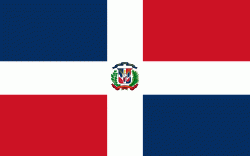
| Flag of the Dominican Republic | |
The native Taíno people had inhabited Hispaniola before the arrival of Europeans, dividing it into five chiefdoms. They had constructed an advanced farming and hunting society, and were in the process of becoming an organized civilization. The Taínos also inhabited Cuba, Jamaica, Puerto Rico, and the Bahamas. The Genoese mariner Christopher Columbus explored and claimed the island for Castile, landing there on his first voyage in 1492. The colony of Santo Domingo became the site of the first permanent European settlement in the Americas and the first seat of Spanish colonial rule in the New World. It would also become the site to introduce importations of enslaved Africans to the Americas. In 1697, Spain recognized French dominion over the western third of the island, which became the independent state of Haiti in 1804.
Currency / Language
| ISO | Currency | Symbol | Significant figures |
|---|---|---|---|
| DOP | Dominican peso | $ | 2 |
| ISO | Language |
|---|---|
| ES | Spanish language |