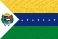
San Fernando de Apure (San Fernando de Apure)
 |
 |
The “Maria Nieves” bridge across the Apure River at San Fernando commenced construction in 1959 under the direction of President Rómulo Betancourt, and was opened February 1, 1961. It cost 8.5 million bolivars. Notable is the Casa de Bolivar, a National Historical Monument, at the intersection of Comercio St. and Independencia St. It is the 18th Century Armory, and was the dwelling of General Miguel Gerrero. Now it contains a public library as well as the cultural offices of the municipality. It was restored in 1983.
San Fernando was founded on February 28, 1788 by order of the Captain of Infantry of the Royal Armies Fernando Miyares y González, military commander, politician and governor of the then newly formed Province of Barinas (1786), and executed by Lieutenant Major Juan Antonio Rodríguez and Fray Buenaventura de Benaocaz, under the denomination of "Villa de San Fernando del Paso Real de Apure".
The foundation was witnessed by about 200 natives in a ceremony where Lieutenant Juan Antonio Rodriguez made a recognition of the land, with which the act describes that the property enjoys good constellation, pure air, abundance of land for labor and breeding, wood for factories, firewood and running water. The Plaza Mayor (now Plaza Bolívar) was then demarcated and a cross was placed on the site where the church would be erected, and the Lieutenant exclaimed: "The Villa Real de San Fernando is hereby founded!"8 Subsequently, in December 1783, given its strategic importance in the domination of Los Llanos, it was officially granted the title of Villa. (Ville)
Between March 27 and 30, 1800, it received the visit of Alexander von Humboldt and five years later (1815), Fray Joaquín María drew up the second map of the town along with a literal description of its limits and jurisdiction.
From the decade of the 30's of the XIX century, educational activity began to take shape in San Fernando, when in 1831, Master Juan Castellanos founded the first private school for minors. Then the Second Category Federal School was created in 1875 and at the end of that century the Leon XIII Federal School was also founded.
The chronicles of the city record that on June 21, 1859, during the Federal War, the Federal Army set fire to a large part of the city, placing it on the verge of destruction.
Then, by 1908, the streets of San Fernando started from a north-south line 100 meters from the east side of the cemetery (now known as the old cemetery) and were usually called: first, second, third, fourth and fifth, the last one reaching the southern end. Between the first and the fifth the village was delimited. Today they are part of the central or historic center of the city with the names of Calle Comercio, Calle Bolívar, Calle Sucre, Calle Páez and Calle Muñoz respectively. At that time, San Fernando was a port on the banks of the Apure River. The main area of the port was about 400 meters long, which was extended a little further to the west when the Barbarito Palace was built. Today the port only appears in historical records, and much of it is now dry land with urban development, where it was once the domain of the Apure River.
At the beginning of the 20th century San Fernando enjoyed great commercial and industrial activity. Food factories (pasta, canned food, sausages, preserves and others), candle factories, ice, heron feather distributors (since 1884), leather and alligator skins, among others, were developed there. Trade maintained a strong relationship with Europe, the main destination of exported products. This activity declined sharply when the demand for exports decreased, when the interest in navigation was reduced due to the development of land trade with the development of the railroad: there was the Gran Ferrocarril de Venezuela line (Caracas to Puerto Cabello) which was to be completed with a branch to San Fernando de Apure, and the development of road trade with the Ford Tablitas (Ford model T, with wooden boards for cargo), which became a true revolution due to its versatility and resistance.
In 1914, the chronicles record the arrival of the first automobile in San Fernando. It is an anecdotal fact. It was a Ford Model T owned by Don Jesús María Hernández M., bought in Cagua by his son-in-law, General Waldino Arriaga.
Map - San Fernando de Apure (San Fernando de Apure)
Map


Country - Venezuela

Currency / Language
| ISO | Currency | Symbol | Significant figures |
|---|---|---|---|
| VES | Venezuelan bolÃvar | BsS. or Bs. | 2 |
| ISO | Language |
|---|---|
| ES | Spanish language |