Salyan Rayon (Salyan Rayon)
Salyan District (Salyan rayonu) is one of the 66 districts of Azerbaijan. It is located in the east of the country and belongs to the Shirvan-Salyan Economic Region. The district borders the districts of Bilasuvar, Sabirabad, Hajigabul, Baku, Neftchala, and the city of Shirvan. Its capital and largest city is Salyan. As of 2020, the district had a population of 139,900.
Salyan was a large, populated area and attracted the attention of the invaders in the XIII century. The approximate time of settlement is the 15th century. Trade relations of Shirvanshahs with Mugan, Tabriz and Iran were passing through Salyan. For a long time in the XVII-XVII century trade routes with Iran, the North Caucasus, Turkestan and Russia passed through Salyan. Fish and caviar from Salyan were transported to these cities for sale. In the 18th century silver, copper money was minted in the district.
In 1795 Agha Mohammad Khan Qajar attacked Shamakhi and completely ruined Salyan because of the confrontation he showed.
In February 1868, the Javad district was established within the Baku province, including Salyan as an administrative unit. Thus Salyan transformed into a cultural centre.
At the beginning of the 20th century, 3 small cotton ginning enterprises with a capacity of 3-4 tons, small heating power stations, 4 elementary schools and a library were founded here. At that time in the city, there were 20 small knitting enterprises, 200 shops, 3 caravan-sheds, 5 trading banks, a ship bridge, a post station, a quarantine station and 11 madrasahs.
In the year 1894, the meteorological station was opened in Salyan for the first time in the whole of Southern Russia and the Caucasus.
Salyan was also the centre of trade, which was located on the Silk Road. Back in the II century AD. merchants from China and India, passing through the current Turkmenbashi (Krasnovodsk) along the sea route, passed through the Caspian depression into the Kura River, the lands of all Azerbaijan, as well as the territory of Salyan, crossed the Rioni River in Georgia, then reached the Poti port on the Black Sea, crossed the Black Sea and fell into the Sea of Azov.
Salyan for a long time was the educational, cultural centre of Mugan and the southeast of Mugan. In 1881 the area of the whole city was 800 acres.
Since 1916, Salyan is officially considered a city.
Map - Salyan Rayon (Salyan Rayon)
Map
Country - Azerbaijan
 |
 |
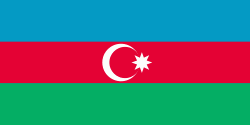
| Flag of Azerbaijan | |
The Azerbaijan Democratic Republic proclaimed its independence from the Transcaucasian Democratic Federative Republic in 1918 and became the first secular democratic Muslim-majority state. In 1920, the country was incorporated into the Soviet Union as the Azerbaijan SSR. The modern Republic of Azerbaijan proclaimed its independence on 30 August 1991, shortly before the dissolution of the Soviet Union in the same year. In September 1991, the ethnic Armenian majority of the Nagorno-Karabakh region formed the self-proclaimed Republic of Artsakh. The region and seven surrounding districts are internationally recognized as part of Azerbaijan pending a solution to the status of the Nagorno-Karabakh through negotiations facilitated by the OSCE, although became de facto independent with the end of the First Nagorno-Karabakh War in 1994. Following the Second Nagorno-Karabakh War in 2020, the seven districts and parts of Nagorno-Karabakh were returned to Azerbaijani control.
Currency / Language
| ISO | Currency | Symbol | Significant figures |
|---|---|---|---|
| AZN | Azerbaijani manat | ₼ | 2 |
| ISO | Language |
|---|---|
| HY | Armenian language |
| AZ | Azerbaijani language |
| RU | Russian language |


