Sakaraha (Sakaraha District)
Sakaraha is a town and municipality in Atsimo-Andrefana Region, south-western Madagascar. It has a population of 31,183 in 2018.
Sakaraha is situated along route nationale No. 7 (Tuléar-Fianarantsoa) at 134 km from Tuléar, 64 km from Andranovory and 84 km from Ilakaka. It is situated at the Zombitse-Vohibasia National Park.
Sakaraha is situated along route nationale No. 7 (Tuléar-Fianarantsoa) at 134 km from Tuléar, 64 km from Andranovory and 84 km from Ilakaka. It is situated at the Zombitse-Vohibasia National Park.
Map - Sakaraha (Sakaraha District)
Map
Country - Madagascar
 |
 |
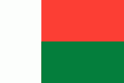
| Flag of Madagascar | |
Madagascar consists of an eponymous main island and numerous smaller peripheral islands. Following the prehistoric breakup of the supercontinent Gondwana, Madagascar split from the Indian subcontinent around 90 million years ago, allowing native plants and animals to evolve in relative isolation; consequently, it is a biodiversity hotspot and one of the world's 17 megadiverse countries, with over 90% of wildlife being endemic. The island has a subtropical to tropical maritime climate.
Currency / Language
| ISO | Currency | Symbol | Significant figures |
|---|---|---|---|
| MGA | Malagasy ariary | Ar | 2 |
| ISO | Language |
|---|---|
| FR | French language |
| MG | Malagasy language |


