St Sampson (Saint Sampson)
St Sampson (Guernésiais: Saint Samsaon) is a parish of Guernsey, an island in the Bailiwick of Guernsey, directly north of St Peter Port. It is on the north-west and north-east coasts of the island and is split into two sections, intersected by Vale.
The parish has a population of 8,966. Its residents are known as roînes (the Guernésiais for frogs).
What is currently the northern boundary of the parish originally ran along the south coast of Le Braye du Valle, a tidal channel that made the northern extremity of Guernsey, Le Clos du Valle, a tidal island. La Braye du Valle was drained and reclaimed in 1806 by the British Government as a defence measure. The eastern end of the former channel became the town and harbour (from 1820) of St. Sampson's, now the second biggest port in Guernsey. The western end of La Braye is now Le Grand Havre. The roadway called The Bridge across the end of the harbour at St. Sampson's recalls the bridge that formerly linked the two parts of Guernsey at high tide.
The parish church of St. Sampson claims to be the oldest of Guernsey's parish churches, standing on the coast where Samson of Dol arrived from Brittany in the sixth century, intending to convert Islanders to Christianity. The church was consecrated on 22 May 1111 by the Bishop of Coutances.
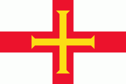
St Sampson is the Patron Saint of Guernsey.
In 1814 there were 125 dwellings, housing 788 residents of Saint Sampson. The parish providing 1/13th of all taxes collected in Guernsey.
Harbour facilities improved as trade using the harbour increased. In 1822, 7,000 tons of granite cobbles were exported in 90 ships. By 1836 annual exports had increased to 57,584 tons. In 1841 the south quay was completed and by 1851, 542 ships were using the harbour each year. By 1861 granite exports had risen to 142,866 tons on 737 ships. Today the harbour is used for non-containerised freight, including liquid and gas fuel.
Shipbuilding took place in Saint Sampson, from local trading craft to a tea clipper called Golden Spur and a steamship, the Commerce built in 1874. The Lydia, a local 173 ton brig, sailed in March 1853 from Saint Sampson to Adelaide with 60 emigrants, it took 132 days.
Trams used to run from Saint Sampson to Saint Peter Port from 1879, taking over from a horse-drawn bus that had started operation in 1837. Originally the trams were steam powered, changing to electric in 1891 and continuing in service until 1934.
The parish has a population of 8,966. Its residents are known as roînes (the Guernésiais for frogs).
What is currently the northern boundary of the parish originally ran along the south coast of Le Braye du Valle, a tidal channel that made the northern extremity of Guernsey, Le Clos du Valle, a tidal island. La Braye du Valle was drained and reclaimed in 1806 by the British Government as a defence measure. The eastern end of the former channel became the town and harbour (from 1820) of St. Sampson's, now the second biggest port in Guernsey. The western end of La Braye is now Le Grand Havre. The roadway called The Bridge across the end of the harbour at St. Sampson's recalls the bridge that formerly linked the two parts of Guernsey at high tide.
The parish church of St. Sampson claims to be the oldest of Guernsey's parish churches, standing on the coast where Samson of Dol arrived from Brittany in the sixth century, intending to convert Islanders to Christianity. The church was consecrated on 22 May 1111 by the Bishop of Coutances.
St Sampson is the Patron Saint of Guernsey.
In 1814 there were 125 dwellings, housing 788 residents of Saint Sampson. The parish providing 1/13th of all taxes collected in Guernsey.
Harbour facilities improved as trade using the harbour increased. In 1822, 7,000 tons of granite cobbles were exported in 90 ships. By 1836 annual exports had increased to 57,584 tons. In 1841 the south quay was completed and by 1851, 542 ships were using the harbour each year. By 1861 granite exports had risen to 142,866 tons on 737 ships. Today the harbour is used for non-containerised freight, including liquid and gas fuel.
Shipbuilding took place in Saint Sampson, from local trading craft to a tea clipper called Golden Spur and a steamship, the Commerce built in 1874. The Lydia, a local 173 ton brig, sailed in March 1853 from Saint Sampson to Adelaide with 60 emigrants, it took 132 days.
Trams used to run from Saint Sampson to Saint Peter Port from 1879, taking over from a horse-drawn bus that had started operation in 1837. Originally the trams were steam powered, changing to electric in 1891 and continuing in service until 1934.
Map - St Sampson (Saint Sampson)
Map


Country - Guernsey
 |
 |
It is the second largest of the Channel Islands, an island group roughly north of Saint-Malo and west of the Cotentin Peninsula. The jurisdiction consists of ten parishes on the island of Guernsey, three other inhabited islands (Herm, Jethou and Lihou), and many small islets and rocks.
Currency / Language
| ISO | Currency | Symbol | Significant figures |
|---|---|---|---|
| GBP | Pound sterling | £ | 2 |
| ISO | Language |
|---|---|
| EN | English language |
| FR | French language |