Saint Mary Parish (Parish of Saint Mary)
Saint Mary is a parish of Antigua and Barbuda on the island of Antigua. It had a population of 7,341 in 2011.
The highest point in the parish is Mount Obama.
The highest point in the parish is Mount Obama.
Map - Saint Mary Parish (Parish of Saint Mary)
Map


Country - Antigua_and_Barbuda
 |
 |
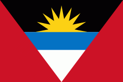
| Flag of Antigua and Barbuda | |
The country consists of two major islands, Antigua and Barbuda, which are approximately 40 km apart, and several smaller islands, including Great Bird, Green, Guiana, Long, Maiden, Prickly Pear, York, and Redonda. The permanent population is approximately 97,120 ( estimates), with 97% residing in Antigua. St. John's, Antigua, is the country's capital, major city, and largest port. Codrington is Barbuda's largest town.
Currency / Language
| ISO | Currency | Symbol | Significant figures |
|---|---|---|---|
| XCD | East Caribbean dollar | $ | 2 |
| ISO | Language |
|---|---|
| EN | English language |