Rufisque Department (Rufisque Department)
There are six urban communes within the department: Bargny, Sébikotane, Diamniadio, Jaxaay-Parcelle-Niakoul Rap, Sangalkam and Sendou. The rest of the department is divided into two arrondissements.
* Rufisque Arrondissement is subdivided into three communes de arrondissement: Rufisque Est, Rufisque Nord and Rufisque Ouest.
* Bambylor Arrondissement is subdivided into 3 rural districts (communautés rurales);
* Yéne
* Bambylor
* Tivaouane Peulh-Niaga
* The historic centre or Old Rufisque, lying between the East Canal, the West Canal, the railway line and the seafront.
* National printworks
* Former William Ponty school at Sébikotane
Map - Rufisque Department (Rufisque Department)
Map


Country - Senegal
 |
 |
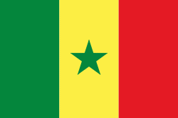
| Flag of Senegal | |
Senegal is notably the westernmost country in the mainland of the Old World, or Afro-Eurasia. It owes its name to the Senegal River, which borders it to the east and north. The climate is typically Sahelian, though there is a rainy season. Senegal covers a land area of almost 197000 km2 and has a population of around million. The state is a unitary presidential republic; since the country's foundation in 1960, it has been recognized as one of the most stable countries on the African continent.
Currency / Language
| ISO | Currency | Symbol | Significant figures |
|---|---|---|---|
| XOF | West African CFA franc | Fr | 0 |
| ISO | Language |
|---|---|
| FR | French language |
| WO | Wolof language |