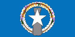
Rota (Rota Municipality)
In 1521, the first European to see Rota was the lookout on Ferdinand Magellan's ship Victoria, Lope Navarro. However, Magellan's armada of three ships did not stop until they reached Guam, so the first European to arrive in Rota (in 1524), was the Spanish navigator Juan Sebastián Elcano, who annexed it together with the rest of the Mariana Islands on behalf of the Spanish Empire.
As with the other islands of the northern Marianas, Rota was sold to the German Empire under the German–Spanish Treaty of 1899. In World War I, the islands were occupied by the Japanese Empire. In 1919, the League of Nations formally recognized Japanese control under the South Seas Mandate. However, development of Rota lagged behind that of neighboring Tinian and Saipan, with only 1000 Japanese residents arriving by the end of December 1935, most of them employed in raising sugar cane and in sugar refining. The refinery was not economical, and it was closed three years later.
The Japanese garrison during World War II consisted of 1,031 Imperial Japanese Army men of the 10th Independent Mixed Brigade, under the command of Major Shigeo Imagawa, and about 600 Imperial Japanese Navy men. During the final stages of the war, Rota was occasionally bombed by aircraft of the U.S. Navy in an attempt to silence its radio transmitter that was providing warning to the Japanese home islands upon the take-off of B-29 Superfortress bomber attacks from Tinian, Saipan, and Guam, but the island was never invaded by American troops. B-29 bombers on Guam would use Rota to dump their bombs should they have a mechanical issue and need to turn back during a raid on Japan. On September 2, 1945, one hour after the surrender of Japan, a detachment of U.S. Marines arrived on Rota to accept the surrender of the Japanese garrison, which numbered 947 Imperial Japanese Army and 1853 Imperial Japanese Navy.
After the end of World War II, Rota became part of the Trust Territory of the Pacific Islands. Since 1978, the island has been a part of the Commonwealth of the Northern Mariana Islands.
The current mayor is Efraim Manglona Atalig.
Map - Rota (Rota Municipality)
Map
Country - Northern_Mariana_Islands
 |
 |
The United States Department of the Interior cites a landmass of 183.5 sqmi. According to the 2020 United States Census, 47,329 people were living in the CNMI at that time. The vast majority of the population resides on Saipan, Tinian, and Rota. The other islands of the Northern Marianas are sparsely inhabited; the most notable among these is Pagan, which for various reasons over the centuries has experienced major population flux, but formerly had residents numbering in the thousands.
Currency / Language
| ISO | Currency | Symbol | Significant figures |
|---|---|---|---|
| USD | United States dollar | $ | 2 |
| ISO | Language |
|---|---|
| CH | Chamorro language |
| ZH | Chinese language |
| EN | English language |
| TL | Tagalog language |


