Rodrigues
 |
 |
Its inhabitants are Mauritian citizens. , the island's population was about 41,669, according to Statistics Mauritius. Most of the inhabitants are of African descent. Its economy is based mainly on fishing, farming, handicraft and a developing tourism sector.
The uninhabited island was named after the Portuguese explorer Diogo Rodrigues in February 1528. Many maps also describe it as Diego Roiz. From the 10th century, Arabs are known to have visited the Mascarene Islands. A 12th-century map by the Arab geographer Ash-Sharif al-Idrisi supposedly contains them, and the Cantino planisphere of c. 1500 and some other contemporary maps clearly show the three islands of the Mascarenes as Dina Arobi (or Harobi), Dina Margabin and Dina Moraze. These are apparently corrupted transliterations or transcriptions of the Arabic ديفا هاراب Diva Harab ("Desert Island"), ديفا مغربين Diva Maghrebin ("Western Island") and ديفا ماشريق Diva Mashriq ("Eastern Island"). While the second clearly refers to Réunion, sources disagree about which of the other is Mauritius and which one Rodrigues, which are both to the east of Réunion and arranged in a somewhat stylised way on these maps. However, even in its original state, Rodrigues had some karst, while Mauritius even after suffering 500 years of deforestation can by no means be called "desert" even in a colloquial sense.
The island was located again in February 1507. Part of the fleet of Afonso de Albuquerque and Tristão da Cunha, Diogo Fernandes Pereira's Cirne spotted Réunion on 9 February after a cyclone diverted their course. The other two islands were subsequently rediscovered. The initial name was Diogo Fernandes; Domingo Froiz was given as a name some years later, and by 1528 it had been again renamed after the Portuguese navigator Dom Diogo Rodrigues and has remained so since. The orthography has been less stable at first, with the name being transcribed Diogo Rodríguez (Spanish maps), Diego Roiz, Diego Ruys (Dutch maps) (or even Diego Ruy's Island), Dygarroys or Bygarroys. Some early French sources called it Île Marianne.
Due to the island lying far off the beaten track of seafarers at that time, it received few visits. From 1601, the Dutch began visiting the island somewhat more regularly for fresh supplies of food. In 1691, the Huguenot François Leguat and seven companions landed on the island, intending to set up a farming colony of Protestant refugees. Farming was not successful, but there was an abundance of tortoises, turtles, birds, fish and other seafood.
During the 18th century, several attempts were made by the French to develop the island. African slaves (ancestors of the present population) were brought to Rodrigues to develop stock-breeding and farming. In 1735 a permanent French settlement was established, subordinated to Île Bourbon.
In 1809, after a brief battle with the French, British troops took possession of Rodrigues. After British occupation, slavery was eventually abolished in 1834. By 1843, the population had declined to a low of 250.
In 1883, the eruption of the Indonesian volcano Krakatoa was heard at Rodrigues Island and it remains the furthest point, at almost 4800 km, at which the explosion was heard. The sound was described as "the roar of heavy guns". Naval ships were ordered to investigate as it was feared the sound was due to a ship in distress firing its guns. Having been heard from about 5000 km away on the other side of the Indian Ocean, the noise remains the loudest sound in recorded history.
In September 1897, solo sailor Joshua Slocum spent eight days on the island. He would later write, "At Rodriguez one may now find every convenience for filling pure and wholesome water in any quantity. Governor Roberts having built a reservoir in the hills, above the village, and laid pipes to the jetty, where, at the time of my visit, there were five and a half feet at high tide. In former years well-water was used, and more or less sickness occurred from it. Beef may be had in any quantity on the island, and at a moderate price. Sweet potatoes were plentiful and cheap; the large sack of them that I bought there for about four shillings kept unusually well. I simply stored them in the sloop's dry hold. Of fruits, pomegranates were most plentiful; for two shillings I obtained a large sack of them, as many as a donkey could pack from the orchard, which, by the way, was planted by nature herself."
Early in 1968, HMS Cambrian, which had been on duties near Beira in east Africa concerning Ian Smith and his unilateral declaration of the independence of Rhodesia, was diverted to Rodrigues to quell a reported uprising by some of the populace. The uprising consisted of a number of individuals who had been arrested by the local authorities for breaking into a warehouse and appropriating a supply of sweet potatoes. Other locals went to the authorities and by violence released the arrested persons. At this point, it is believed that the authorities requested assistance which was provided by HMS Cambrian. On her early morning arrival, the ship's 4.5" guns were fired (with blanks, it is believed) and an armed landing party was provided. This resulted in the offenders being rounded up and imprisoned again.
Map - Rodrigues
Map


Country - Mauritius
 |
 |
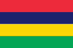
| Flag of Mauritius | |
Arab sailors were the first to discover the uninhabited island, around 975, and they called it Dina Arobi. In 1507, Portuguese sailors visited the uninhabited island. The island appears with the Portuguese names Cirne or Do-Cerne on early Portuguese maps. The Dutch took possession in 1598, establishing a succession of short-lived settlements over a period of about 120 years, before abandoning their efforts in 1710. France took control in 1715, renaming it Isle de France. In 1810, the United Kingdom seized the island, and four years later, in the Treaty of Paris, France ceded Mauritius and its dependencies to the United Kingdom. The British colony of Mauritius included Rodrigues, Agaléga, St. Brandon, the Chagos Archipelago, and, until 1906, the Seychelles. Mauritius and France dispute sovereignty over the island of Tromelin as the Treaty of Paris failed to mention it specifically. Mauritius remained a primarily plantation-based colony of the United Kingdom until independence in 1968.
Currency / Language
| ISO | Currency | Symbol | Significant figures |
|---|---|---|---|
| MUR | Mauritian rupee | ₨ | 2 |
| ISO | Language |
|---|---|
| EN | English language |
| FR | French language |