Rio Grande do Sul (Rio Grande do Sul)
 |
The state shares a gaucho culture with its neighbors Argentina and Uruguay. Before the arrival of Portuguese and Spanish settlers, it was inhabited mostly by the Guarani and Kaingang peoples (with smaller populations of Charrúa and Minuane). The first Europeans there were Jesuits, followed by settlers from the Azores. In the 19th century it was the scene of conflicts including the Ragamuffin War and the Paraguayan War. Large waves of German and Italian migration have shaped the state as well.
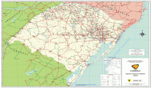
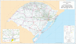
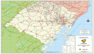
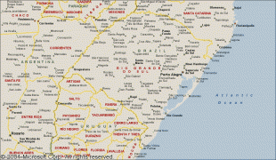
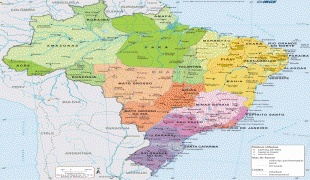
Rio Grande do Sul is bordered to the northeast by the Brazilian State of Santa Catarina, to the southeast by the Atlantic Ocean, on the southwest by Uruguay, and to the northwest by the Argentine provinces of Corrientes and Misiones.
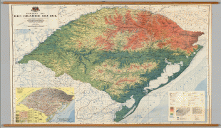
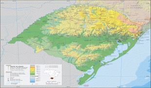
The northern part of the state lies on the southern slopes of the elevated plateau extending southward from São Paulo across the states of Paraná and Santa Catarina, and is much broken by low mountain ranges whose general direction across the trend of the slope gives them the appearance of escarpments. A range of low mountains extends southward from the Serra do Mar of Santa Catarina and crosses the state into Uruguay. West of this range is a vast grassy plain devoted principally to stock-raising – the northern and most elevated part being suitable in pasturage and climate for sheep, and the southern for cattle. East of it is a wide coastal zone only slightly elevated above the sea; within it are two great estuarine lagoons, the Lagoa dos Patos and Lagoa Mirim, which are separated from the ocean by two sandy, partially barren peninsulas. The coast is one great sand beach, broken only by the outlet of the two lakes, called the Rio Grande, which affords an entrance to navigable inland waters and several ports. There are two distinct river systems in Rio Grande do Sul – that of the eastern slope draining to the lagoons, and that of the Río de la Plata basin draining westward to the Uruguay River.
The larger rivers of the eastern group are the Jacuí, Sinos, Caí, Gravataí and Camaquã, which flow into the Lagoa dos Patos, and the Jaguarão which flows into the Lagoa Mirim. All of the first named, except the Camaquã, discharge into one of the two arms or estuaries opening into the northern end of Lagoa dos Patos, which is called the Guaíba River, though technically it is not a river but a lake. The Guaíba River is broad, comparatively deep and about 56 km long, and with the rivers discharging into it affords upwards of 320 km of fluvial navigation. The Jacuí is one of the most important rivers of the state, rising in the ranges of the Coxilha Grande of the north and flowing south and southeast to the Guaíba estuary, with a course of nearly 480 km It has two large tributaries, the Vacacaí from the south and the Taquari from the north, and many small streams. The Jaguarão, which forms part of the boundary line with Uruguay, is navigable 42 km up to and beyond the town of Jaguarão. In addition to the Lagoa dos Patos and Lagoa Mirim there are a number of small lakes on the sandy, swampy peninsulas that lie between the coast and these two, and there are others of a similar character along the northern coast. The largest lake is the Lagoa dos Patos (Lake of the Patos – an Indian tribe inhabiting its shores at the time of European discovery), which lies parallel with the coastline, northeast and southwest, and is about 214 km long exclusive of the two arms at its northern end, 40 58 km long respectively, and of its outlet, the Rio Grande, about 39 km long. Its width varies from 35 to 58 km. The lake is comparatively shallow and filled with sand banks, making its navigable channels tortuous and difficult. The Lagoa Mirim occupies a similar position farther south, on the Uruguayan border, and is about 175 km long by 10 to 35 km wide. It is more irregular in outline and discharges into Lagoa dos Patos through a navigable channel known as the São Gonçalo Channel. A part of the lake lies in Uruguayan territory, but its navigation, as determined by treaty, belongs exclusively to Brazil. Both of these lakes are evidently the remains of an ancient depression in the coastline shut in by sand beaches built up by the combined action of wind and current. They are of the same level as the ocean, but their waters are affected by the tides and are brackish only a short distance above the Rio Grande outlet.
Fully one-third of the state belongs to the Río de la Plata drainage basin. Of the many streams flowing northward and westward to the Uruguay, the largest are the Ijuí of the plateau region, the Ibicuí, which has its source near Santa Maria in the central part of the state and flows westward to the Uruguay a short distance above Uruguaiana, and the Quaraí River which forms part of the boundary line with Uruguay. The Uruguay River itself is formed by the confluence of the Canoas and Pelotas rivers. The Pelotas, which has its source in the Serra do Mar on the Atlantic coast, and the Uruguay River forms the northern and western boundary line of the state down to the mouth of the Quaraí, on the Uruguayan frontier.
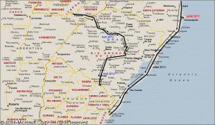
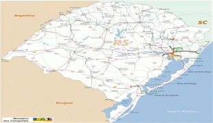
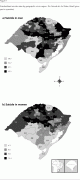
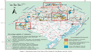
Map - Rio Grande do Sul (Rio Grande do Sul)
Map


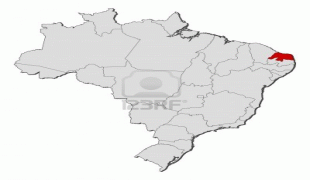


Country - Brazil


Currency / Language
| ISO | Currency | Symbol | Significant figures |
|---|---|---|---|
| BRL | Brazilian real | R$ | 2 |
| ISO | Language |
|---|---|
| EN | English language |
| FR | French language |
| PT | Portuguese language |
| ES | Spanish language |


