Redonda
Redonda is an uninhabited Caribbean island that is a part of Antigua and Barbuda, in the Leeward Islands, West Indies. The island is about 1 mi long, 0.3 mi wide, and is 971 ft high at its highest point.
This small island lies between the islands of Nevis and Montserrat, 56.2 km southwest of Antigua. Redonda is closer to Montserrat than to any other island; it is located at 22.5 km northwest of Montserrat, and 32 km southeast of Nevis.
Redonda is home to vast numbers of sea birds, and the island was an important source of guano before artificial fertilisers started to be mass-produced. Guano-mining operations started in the 1860s and ceased after the start of World War I. During these mining operations a few buildings and other installations were put in place on the island, and some physical remnants of that phase in its history are still visible.
"Redonda" is the female form of the Spanish language adjective meaning "round". In 1493, on his second voyage to the New World, Christopher Columbus discovered the island and named it "Santa María la Redonda" (the Spanish language meaning "Saint Mary the Round").
The island was annexed by the Antiguan Parish of Saint John on the 26th of March, 1872.
At a distance, Redonda appears as if it were one very large rock. It is the remnant of an ancient extinct volcano. The land rises from sea level mostly as sheer cliffs, especially on the leeward (west) side. At the top of the island there is a relatively flat but tilted area of grassland which slopes to the east. There is no source of fresh water other than rain.
Judging by the name he gave the island, to Columbus the island appeared to be rounded, at least in profile. In reality the island is long and narrow, and reaches a height of almost 1,000 feet. The actual land area of the island is hard to estimate because of the extreme steepness of the slopes, but it is calculated to be somewhere between 1.6 km2 and 2.6 km2.
Redonda is uninhabited. The difficult topography, the lack of a safe place to land a boat, and the absence of any freshwater source other than rainfall makes the island inhospitable to humans.
A herd of feral goats and thousands of rats were cleared from the island in 2017 as part of a island restoration programme.
Map - Redonda
Map


Country - Antigua_and_Barbuda
 |
 |
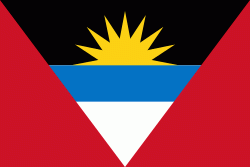
| Flag of Antigua and Barbuda | |
The country consists of two major islands, Antigua and Barbuda, which are approximately 40 km apart, and several smaller islands, including Great Bird, Green, Guiana, Long, Maiden, Prickly Pear, York, and Redonda. The permanent population is approximately 97,120 ( estimates), with 97% residing in Antigua. St. John's, Antigua, is the country's capital, major city, and largest port. Codrington is Barbuda's largest town.
Currency / Language
| ISO | Currency | Symbol | Significant figures |
|---|---|---|---|
| XCD | East Caribbean dollar | $ | 2 |
| ISO | Language |
|---|---|
| EN | English language |