Pétionville
Pétion-Ville (Petyonvil) is a commune and a suburb of Port-au-Prince, Haiti, in the hills east and separate from the city itself on the northern hills of the Massif de la Selle. Founded in 1831 by president Jean-Pierre Boyer, it was named after Alexandre Sabès Pétion (1770–1818), the Haitian general and president later recognized as one of the country's four founding fathers.
The district is primarily a residential and touristic area. It had a population of 283,052 at the 2003 Census, which was officially estimated to have reached 376,834 in 2015. Many diplomats, foreign businessmen, and wealthy citizens engage in business and reside in Pétion-Ville.
Despite the distance from the capital and the general affluence of the district, the lack of administrative enforcement has led to the formation of shantytowns on the outer edges of the district, as poor locals migrate upward and have settled there in search of job opportunities. On 28 or 29 August 2020, Haitian Lawyer Monferrier Dorval was assassinated in front of his home. On 7 July 2021, Haitian president Jovenel Moïse was assassinated at his private residence between 1:00-2:00 AM local time.
The gated and privately guarded neighborhoods of Pétion-Ville resemble a Haitian version of Beverly Hills, but with barbed wire. The community is very stable, with nightlife and business conducted with an appearance of western normality, in striking contrast to many other parts of greater Port-au-Prince.
The hillside suburban town is filled with nightclubs, beauty salons, fitness gyms and restaurants. Businesses which cater to tourists are commonplace, and parties and get-togethers often take place at night. Establishments often host considerable numbers of expatriates and foreigners.
The "El Rancho" hotel is in Pétion-Ville. It was built from the private estate of Albert Silvera, a sports and luxury car collector who was one of the pioneers of Haiti's hotel industry.
Map - Pétionville
Map
Country - Haiti
 |
 |
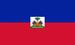
| Flag of Haiti | |
The island was originally inhabited by the indigenous Taíno people, who originated in South America. The first Europeans arrived on 5 December 1492 during the first voyage of Christopher Columbus, who initially believed he had found India or China. Columbus subsequently founded the first European settlement in the Americas, La Navidad, on what is now the northeastern coast of Haiti. The island was claimed by Spain and named La Española, forming part of the Spanish Empire until the early 17th century. However, competing claims and settlements by the French led to the western portion of the island being ceded to France in 1697, which was subsequently named Saint-Domingue. French colonists established lucrative sugarcane plantations, worked by vast numbers of slaves brought from Africa, which made the colony one of the richest in the world.
Currency / Language
| ISO | Currency | Symbol | Significant figures |
|---|---|---|---|
| HTG | Haitian gourde | G | 2 |
| USD | United States dollar | $ | 2 |
| ISO | Language |
|---|---|
| FR | French language |
| HT | Haitian Creole language |


