Pyeongtaek
Pyeongtaek is a city in Gyeonggi Province, South Korea. Located in the southwestern part of the province, Pyeongtaek was founded as a union of two districts in 940, during the Goryeo dynasty. It was elevated to city status in 1986 and is home to a South Korean naval base and a large concentration of United States troops. The South Korean government plans to transform Pyeongtaek city to an international economic hub to coincide with the move of the United States Forces Korea (USFK) to Pyeongtaek. During the Korean War, it was the site of an early battle between U.S. and North Korean forces, the Battle of Pyongtaek. It is the location of Pyeongtaek University.
The South Korean and United States governments came to an agreement to enlarge Camp Humphreys — a U.S. Army installation outside Anjeong-ri, a community in Pyeongtaek — and move the majority of US forces stationed in and north of Seoul to the Camp Humphreys area. Invoking eminent domain, the government obtained the surrounding land for the base expansion. This would result in the community's third displacement from their own land since the Japanese occupation during World War II.
The move originally included the headquarters of the ROK/US Combined Forces Command, which has operational control of South Korean, U.S., and U.N. combined forces during wartime. In March 2007, ROK Minister of Defense Kim Jang-soo and U.S. Secretary of Defense Robert Gates agreed to dissolve the ROK-U.S. Combined Forces Command on April 17, 2012. This would allow ROK forces to have wartime control of its military during a military confrontation with the North. The ROK/US agreement allows USFK to move to one centralized location away from the congestion of Seoul and its surrounding areas. This relocation agreement results in returning two-thirds of the land currently used by the United States Military back to the South Korean government. By 2008, the U.S. military was to have consolidated 41 installations down to 10 due to the relocation agreement. USFK's only jail facility in South Korea is at Camp Humphreys. Osan Air Base is in Songtan, a district in Pyeongtaek City.
Map - Pyeongtaek
Map
Country - South_Korea
 |
 |
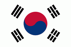
| Flag of South Korea | |
The Korean Peninsula was inhabited as early as the Lower Paleolithic period. Its first kingdom was noted in Chinese records in the early 7th century BCE. Following the unification of the Three Kingdoms of Korea into Silla and Balhae in the late 7th century, Korea was ruled by the Goryeo dynasty (918–1392) and the Joseon dynasty (1392–1897). The succeeding Korean Empire (1897–1910) was annexed in 1910 into the Empire of Japan. Japanese rule ended following Japan's surrender in World War II, after which Korea was divided into two zones; a northern zone occupied by the Soviet Union and a southern zone occupied by the United States. After negotiations on reunification failed, the southern zone became the Republic of Korea in August 1948 while the northern zone became the communist Democratic People's Republic of Korea the following month.
Currency / Language
| ISO | Currency | Symbol | Significant figures |
|---|---|---|---|
| KRW | South Korean won | â‚© | 0 |
| ISO | Language |
|---|---|
| EN | English language |
| KO | Korean language |


