Pursat Province (Pursat)
The fourth largest province of Cambodia in area, Pursat ranks only 14th in population. The region is accessible by National Highway 5, by boat, rail and by numerous smaller roads. The capital, Pursat town, lies 174 kilometres north west of Phnom Penh by road and 106 kilometres south east of Battambang.
Pursat is home to Wat Bakan, considered to be among the oldest active pagodas in Cambodia and revered as one of the most holy sites of Cambodian Buddhism. The province also hosts the annual River Run Race, an event that includes 5 km and 10 km races that generally follow the path of the Pursat River for men and women, including those requiring wheelchairs. Since its inaugural race in 2007, the event has grown to the second largest of its kind in Cambodia
Pursat is derived from the transliteration of its name in Khmer script Poŭthĭsăt (ពោធិ៍សាត់) means "floating banyan" in Khmer. It’s composed of Poŭthĭ- (ពោធិ៍, ), a Khmer word derived from the Sanskrit and Pali word of the tree named bodhi (बोधि), which is where the Buddha became enlightened, and -săt (សាត់, ) which comes from the Khmer word rôsăt (រសាត់, ) meaning "to float".
Map - Pursat Province (Pursat)
Map
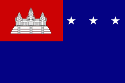
Country - Khmer_Republic
 |
 |
| Flag of Cambodia | |
The main cause of the coup was Norodom Sihanouk's tolerance of North Vietnamese military activity within Cambodia's borders; Vietnamese communist forces had gained de facto control over vast areas of eastern Cambodia as a result. Another important factor was the dire state of the Cambodian economy, an indirect result of Sihanouk's policies of pursuing neutrality.
Currency / Language
| ISO | Currency | Symbol | Significant figures |
|---|---|---|---|
| KHR | Cambodian riel | ៛ | 2 |
| ISO | Language |
|---|---|
| KM | Central Khmer language |
| EN | English language |
| FR | French language |


